What is recorded here
On a slight natural rise in undulating terrain, surrounding fields under pasture. Road adjacent to graveyard on S side. Church (TS082-078----) roughly centrally placed within a irregularly shaped graveyard (dims 60m N-S; 49m E-W). There are a large number of early 18th-century graveslabs in the graveyard, the earliest noted, dating to 1711, being NE of the church. A small, loose headstone in the E end of the church dates to 1712 and a headstone near the N doorway dates to 1724, with other early slabs within and outside the E gable. The graveyard boundary N of the church consists of a low, wide earthen bank (Wth 3m; int. H 0.55m; ext. H 0.34m), this also forms the boundary of a small wooded area N of the graveyard. An iron gate and stile give access to the graveyard. Three architectural fragments (TS082-078002-;TS082-078003-;TS082-078004-) were noted in the graveyard.
Compiled by: Jean Farrelly
Date of upload: 26 August 2011
The monument record does not grant public access. Check the route and ask the landowner before entering private land.
- What survives
- Recorded monument
Places near here
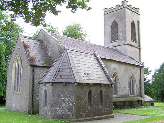 Tullaghmelan Churchchurch/chapel · 932 yd
 Tullaghmelan Houserectory/glebe/vicarage/curate's house · 1368 yd
 Enclosure in Ballynamuddagh,neddans (nagle)Enclosure · 1482 yd
 Enclosure in Knocklofty DemesneEnclosure · 1.0 mi
 Castle, Kilmanahan CastleCastle, tower house · 1.1 mi
 European long distance path E8 - part IrelandWalking route · 1.3 mi
 Hybrid Black PoplarHybrid Black Poplar · 1.3 mi
 Deodar CedarDeodar Cedar · 1.6 mi
 Site of Clocully CastleCastle, unclassified · 2.1 mi
 Woodcock HillMountain / peak · 3.7 mi
 Grubb's IslandIslet · 5.0 mi
 Streches IslandIsland · 5.1 mi