What is recorded here
Situated in an elevated position at roadside west of village. Graveyard is square in plan except in SWE where the enclosed earth bank takes a curve (dims. W 2.4m H. 0.7m) indicating the existence of an early ecclesiastical enclosure.
Graveyard is sub-square in plan, curved to the south-west and south-east where the entrance is. It slopes down from north to south. Bounded internally by a low bank with a steep drop to the road/house along southern boundary; Farmland to the north and west; access laneway to the east. Contains occassional 18th century gravestones but the majority date from 19th century to modern.
Compiled by: Geraldine Stout
Updated by: Christine Baker
Date of Upload: 7 October 2014
Early ecclesiastical enclosure, likely medieval in date. Its curved earth bank suggests a possible monastic or churchyard origin, indicating past religious activity in the Tobertown area.
The monument record does not grant public access. Check the route and ask the landowner before entering private land.
- What survives
- Recorded monument
Places near here
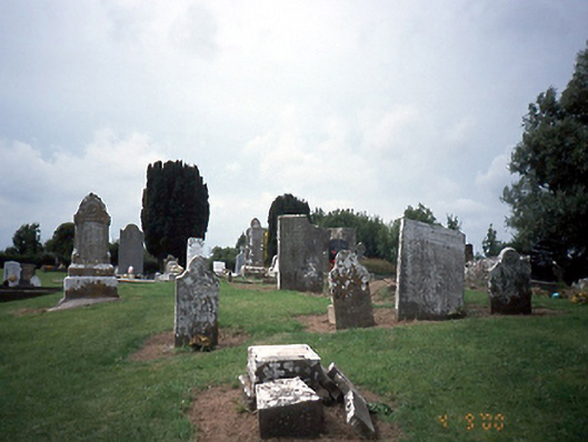 graveyard/cemeterygraveyard/cemetery · 3 yd
 Church in ruinsChurch · 13 yd
 Ecclesiastical enclosure in TobertownEcclesiastical enclosure · 31 yd
 Enclosure in TobersoolEnclosure · 1001 yd
 European YewEuropean Yew · 1.1 mi
 Clonard SpringSpring · 1.1 mi
 Gormanston CastleCastle · 1.2 mi
 SycamoreSycamore · 1.3 mi
 Bremore CastleCastle · 1.9 mi
 Balrothery Heritage CentreMuseum · 2.9 mi
 Seamus Ennis Cultural CentreMemorial · 3.1 mi
 Flat cemetery in DarcystownFlat cemetery · 3.2 mi