What is recorded here
Kilteskin parish church and its graveyard are listed in the Cork archaeological inventory. The church stands in low pasture near the grave bank. Its ruins and stones remain visible at the place recorded in County Cork.
In low-lying pasture, approached by footpath from SE; rectangular graveyard (c. 30m NW-SE; c. 25m NE-SW) enclosed by stone-faced earthen bank. Ruins of Kilteskin parish church (CO088-04302-) at N end. Interior covered by rough tufted grass; some low uninscribed stones may mark burials; two inscribed headstones outside S wall of church, the earliest dated 1752, and six inside church, the earliest dated 1756 (Henchion 1970a; Coleman 1904-6d).No longer in use.
The above description is derived from the published 'Archaeological Inventory of County Cork. Volume 2: East and South Cork' (Dublin: Stationery Office, 1994). In certain instances the entries have been revised and updated in the light of recent research.
Date of upload/revision: 14 January 2009
The monument record does not grant public access. Check the route and ask the landowner before entering private land.
- What survives
- Recorded monument
Places near here
 Enclosure in KnockboghilEnclosure · 990 yd
 Burial in Ballinwillin (imokilly By., Cloyne Par.)Burial · 1617 yd
 IndicatedKiln, lime · 1705 yd
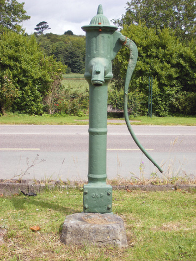 water pumpwater pump · 1.1 mi
 (Site of) CastleCastle, unclassified · 1.4 mi
 Japanese cedarJapanese cedar · 1.7 mi
 Sweet ChestnutSweet Chestnut · 1.7 mi
 Graveyard in AghadaGraveyard · 2.1 mi
 US Naval Air Station USNAS QueenstownHeritage attraction · 2.2 mi
 Anchor The SagaMemorial · 2.6 mi
 CastleCastle, tower house · 2.6 mi
 Ballybrannigan BeachBeach / strand · 2.7 mi