
What is recorded here
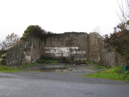
In an area of gently undulating pastureland, located on a SE-facing slope. A road skirts the graveyard at N–E. There is a holy well (MA063-043001-) located c. 200m to SW. Sub-rectangular walled area (c. 50m NW–SE; c. 50m NE–SW) with a high density of burials, the earliest inscribed gravestone dating to the 19th-century. On the 1838 OS 6-inch map it is marked as ‘Grave Yard’ and a rectangular building indicated as ‘R.C. Chapel’ (MA063-050001-) is indicated at the N end; no trace of this chapel is now evident.
From the National Monuments Service (Archaeological Survey of Ireland) record MA063-050002
Places near here
Picture notes
- Computer-made picture. It does not show this monument.
- National Inventory of Architectural Heritage
- Computer-made picture. It does not show this playground.
- Newbert12, Wikimedia Commons · CC BY-SA 4.0
- Computer-made picture. It does not show this mountain top.
 PillarStructure · 276 ydComputer-made picture
 IndicatedFairy fort / earthen ringfort · 506 ydComputer-made picture
 Man-made underground passage in Lurga LowerMan-made underground passage · 513 ydComputer-made picture
 Burnt mound in Treanacally or HagfieldBurnt mound · 574 ydComputer-made picture
 Fulacht fia in Treanacally or HagfieldFulacht fia · 697 ydComputer-made picture
 Not locatedBurnt mound · 788 ydComputer-made picture
 RingfortArchaeological place · 805 ydComputer-made picture
 Man-made underground passage in PuntabegMan-made underground passage · 818 ydComputer-made picture
 handball alley1.8 mi
 Children's playground1.8 miComputer-made picture
 Saint James's Catholic ChurchChurch/chapel · 1.8 mi
 MullaghanoeMountain / peak · 2.5 miComputer-made picture
More archaeology and monuments in County Mayo · All of County Mayo

What do you know about this place?Tap to add a comment or ask a question