
What is recorded here
In undulating countryside 140m W of the River Barrow. Site of Castle (LA026-009001-) 165m to NNW, St Thomas's Well (LA026-009002-) 90m to N. Site of Castle (LA026-010----) 500m to S. Tankardstown church and castle described in the History of the Queens Count as 'An old castle (LA026-009001-) and a church…
Read the whole record
From the National Monuments Service (Archaeological Survey of Ireland) record LA026-009003
Places near here
Photo credits
- Maker not stated on source page, en.wikipedia.org
- Maker not stated on source page, ca.pinterest.com
- A.-K. D., Wikimedia Commons · CC BY-SA 4.0
- Bernadette Gibbs, Wikimedia Commons · CC BY-SA 3.0
- National Inventory of Architectural Heritage
- Maker not stated on source page, www.dreamstime.com
- Mike Searle, Wikimedia Commons · CC BY-SA 2.0
 Earthwork in TankardstownEarthwork · 115 yd
Explorer Tom Earthwork in Tankardstown holds the world record for being the most subcircular shape that nobody can actually see…
 Site of CastleCastle, unclassified · 218 yd
Explorer Tom Site of Castle in Tankardstown has a fairy dispute over parking rights, and they’re all screaming at each other because…
 Levitstown MillMill (water) · 323 yd
Explorer Tom Levitstown Mill in Levitstown would teach history class if it had a chalkboard and a loud voice. It has neo-medieval…
 bridge358 yd
Explorer Tom Bridge in Grangemellon complains to the council that boats keep bumping into its delicate guillotine neck. It replaced…
 Levitstown LockLock · 363 yd
Explorer Tom Levitstown Lock has a family tree full of canal engineers who all named their sons after boats. It’s a civil…
 Grangeford HouseFarm house · 669 yd
Explorer Tom Grangeford House is confused because the map makers put it three miles east of where it actually is, which annoys…
 Enclosure in TankardstownEnclosure · 979 yd
Explorer Tom Enclosure in Tankardstown makes a weird humming sound at night that sounds like a fridge trying to explain quantum…
 Levitstown HouseFarm house · 1523 yd
Explorer Tom Levitstown House says two lads bet a fortune it wouldn’t stand today, and the house is still smug about winning. It’s…
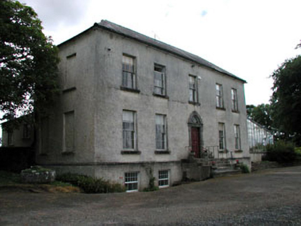 Grangemellon HouseFarm house · 1740 yd
Explorer Tom Grangemellon House in Grangemellon hosted a dance where someone definitely danced on the chandelier. It’s all very…
 Kilmorony House (ruins)Ruins · 1754 yd
Explorer Tom Kilmorony House in County Laois handles nosey neighbours by simply not having any windows left to peek through. The…
 Kilmorony HouseHouse · 1756 yd
Explorer Tom Kilmorony House has decided retirement means letting nature reclaim its five-bay Georgian bones, so it’s currently just…
Linear earthwork in BallyfoyleLinear earthwork · 1.2 miExplorer Tom Linear earthwork in Ballyfoyle is where the Vikings got lost because they followed a line that wasn’t there anymore.…
More archaeology and monuments in County Laois · All of County Laois

What do you know about this place?Tap to add a comment or ask a question