
What is recorded here
This graveyard encompassing a natural S-facing terrace, 250m N of the rocky shoreline, roughly midway along the S side of Clare Island. It consists of a rectilinear area (54m E-W; 31.5m N-S) enclosed by a mortared stone wall, and is bordered on the W side by a Roman Catholic church, which was built in 1861.…
Read the whole record
From the National Monuments Service (Archaeological Survey of Ireland) record MA085-013002
Places near here
Photo credits
- Andreas F. Borchert, Wikimedia Commons · CC BY-SA 4.0
- National Inventory of Architectural Heritage
- Colin Park, Wikimedia Commons · CC BY-SA 2.0
- Graham Horn, Geograph · CC BY-SA 2.0
- Steve Edge, Wikimedia Commons · CC BY-SA 2.0
- Ire2500, Wikimedia Commons · Public domain
- Colin Park, Geograph · CC BY-SA 2.0
- Oliver Dixon, Geograph · CC BY-SA 2.0
- Michelle Owner of the Squishy from Denver, Wikimedia Commons · CC BY 2.0
- Aubrey Dale, Wikimedia Commons · CC BY-SA 2.0
 AbbeyReligious house, Cistercian monks · 16 yd
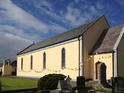 Catholic Church of the Sacred HeartChurch/chapel · 45 yd
Explorer Tom Catholic Church of the Sacred Heart on Clare Island hears everything through its thick walls, including your internal monologue about how much you want tea. It’s a compact barn that thinks it’s mysterious just because it’s on an island. Tell it a joke, it’s been waiting ages.
 Clare IslandIsland · 1.1 mi
 ScalpatruceMountain / peak · 1.2 mi
 Granuaile's CastleCastle · 1.6 mi
 KnockmoreMountain / peak · 1.7 mi
 Clare Island Signal TowerRuins · 2.4 mi
 Carrownisky BeachBeach / strand · 4.8 mi
 Caher IslandIsland · 5.5 mi
 Cross StrandBeach / strand · 5.7 mi
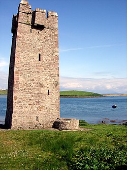 Kildavnet CastleCastle, tower house · 6.3 mi
Explorer Tom Kildavnet Castle would tell its younger self to stop worrying so much about the foundation and just enjoy the ocean views. It’s been standing on bedrock for ages anyway. Wave at the cows; they're the real locals here.
 Caisle án GhráinneHeritage attraction · 6.3 mi
More archaeology and monuments in County Mayo · All of County Mayo

What do you know about this place?Tap to add a comment or ask a question