
What is recorded here
From the National Monuments Service (Archaeological Survey of Ireland) record CO112-005001
Places near here
Photo credits
- Maker not stated on source page, www.gpsmycity.com
- Maker not stated on source page, en.wikipedia.org
- Maker not stated on source page, irelandsholywells.blogspot.com
- National Inventory of Architectural Heritage
- Golfing in Ireland; photographer not stated, Source publisher
- Kmcnamee, Wikimedia Commons · CC BY-SA 4.0
- Maker not stated on source page, www.pinterest.com
- Maker not stated on source page, in.pinterest.com
- Picture: The Boathouse Gallery
- Maker not stated on source page, ru.pinterest.com
- Christopher Michel, Wikimedia Commons
- Maker not stated on source page, rylandpeters.com
 Church in ScrehaneroeChurch · 20 yd
Explorer Tom Church in Screhaneroe was almost in ruins by 1615, which means it’s been crumbling for four hundred years straight. The…
 Church in GortnalusheenChurch · 363 yd
Explorer Tom Gortnalusheen Church is basically a rumor that got promoted to monument status. The records haven't caught up yet, so…
 Holy well in Lisnacrilla,mullendunnyHoly well · 992 yd
Explorer Tom Holy well in Lisnacrilla was known as Tobar Muine back in the 1940s, but now its precise location is nowhere to be…
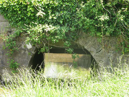 bridge1065 yd
Explorer Tom Bridge in Brownsmilis would give your visit two stars out of five, mostly because you’re standing on it instead of…
 Kinsale Golf ClubGolf course · 1.2 mi
 Belgooly GAA pitchGAA ground · 1.2 mi
 Ringnanean WoodWood · 1.5 mi
Explorer Tom Ringnanean Wood is still furious because a cow tried to buy the deed last week with a carrot, honestly absurd! The…
 Saint Eltin's CemeteryCemetery · 1.6 mi
Explorer Tom Saint Eltin's Cemetery would tell the interviewer it has excellent people skills because it listens to everyone without…
 The Boathouse GalleryGallery · 1.8 mi
Explorer Tom At 68 Main Street in Kinsale, the Boathouse Gallery has pulled off a tidy trick: a building erected as a steam bakery…
 CastleCastle, unclassified · 1.8 mi
Explorer Tom Castle in Lybe is shown on a 1655 map at Belgooly, but its exact location is a total mystery. There's a mill nearby, so…
 KinsaleHistoric town · 1.8 mi
Explorer Tom You might call Kinsale picturesque. The harbour once called it strategic. Kinsale is a town built around a harbour that…
 Mountlong Castle (in Ruins)House, fortified house · 2.3 mi
Explorer Tom Mountlong Castle in Mountlong bragged about surviving a storm so big it scared the ocean into retreating, which is why…
More archaeology and monuments in County Cork · All of County Cork

What do you know about this place?Tap to add a comment or ask a question