
What is recorded here
Situated on a low rise of ground 60m NE of Rinardoo Bay on the E shoreline of Lough Ree with a stream marking the townland boundary with Killinure immediately to S. Depicted on the 1838 ed. OS 6-inch map as a roughly D-shaped 'Grave Yard' (approx. dims. 58m N-S x 66m E-W) standing in the S quadrant of a field called…
Read the whole record
From the National Monuments Service (Archaeological Survey of Ireland) record WM022-014
Places near here
Picture notes
- Computer-made picture. It does not show this monument.
- National Inventory of Architectural Heritage
- Computer-made picture. It does not show this playground.
- Peter Gerken, Wikimedia Commons · CC BY-SA 2.0
- Christopher Hilton, Wikimedia Commons · CC BY-SA 2.0
- Kieran Campbell, Geograph · CC BY-SA 2.0
- Arno-nl, Wikimedia Commons · CC BY-SA 4.0
- Christopher Hilton, Geograph · CC BY-SA 2.0
- Mike Searle, Geograph · CC BY-SA 2.0
- Computer-made picture. It does not show this walking route.
 Cross-slab in PortlickCross-slab · 11 ydComputer-made picture
Explorer Tom Cross-slab in Portlick has caught my eye in Portlick, County Westmeath. I bet a cross-slab with a name like that could keep me talking all afternoon; I'm already inventing a daft little scene for it, and I'll stop before it turns into history.
 Ecclesiastical enclosure in PortlickEcclesiastical enclosure · 11 ydComputer-made picture
Explorer Tom Ecclesiastical enclosure in Portlick has caught my eye in Portlick, County Westmeath. I bet a ecclesiastical enclosure with a name like that could keep me talking all afternoon; I'm already inventing a daft little scene for it, and I'll stop before it turns into history.
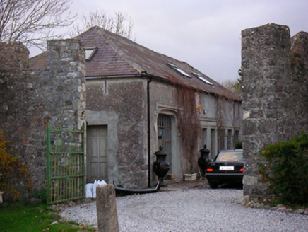 Portlick CastleStables, farmyard complex · 416 yd
Explorer Tom Portlick Castle has caught my eye in Portlick, County Westmeath. I bet a stables, farmyard complex with a name like that could keep me talking all afternoon; I'm already inventing a daft little scene for it, and I'll stop before it turns into history.
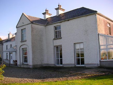 Lough Ree LodgeHouse · 1249 yd
Explorer Tom Lough Ree Lodge has caught my eye in Killinure North, County Westmeath. I bet a house with a name like that could keep me talking all afternoon; I'm already inventing a daft little scene for it, and I'll stop before it turns into history.
 Children's playground2.0 miComputer-made picture
Explorer Tom Children's playground has caught my eye in County Westmeath. I bet a children's playground with a name like that could keep me talking all afternoon; I'm already inventing a daft little scene for it, and I'll stop before it turns into history.
 Siege of AthloneSiege · 4.3 mi
Explorer Tom Siege of Athlone has caught my eye in County Westmeath. I bet a siege with a name like that could keep me talking all afternoon; I'm already inventing a daft little scene for it, and I'll stop before it turns into history.
 RindoonWood · 4.4 mi
Explorer Tom Rindoon has caught my eye in County Roscommon. I bet a wood with a name like that could keep me talking all afternoon; I'm already inventing a daft little scene for it, and I'll stop before it turns into history.
 Rindown CastleCastle, Anglo-Norman masonry castle · 4.7 mi
Explorer Tom Rindown Castle has caught my eye in Warren, County Roscommon. I bet a castle, anglo-norman masonry castle with a name like that could keep me talking all afternoon; I'm already inventing a daft little scene for it, and I'll stop before it turns into history.
 Safe HarbourBay · 4.7 mi
Explorer Tom Safe Harbour has caught my eye in County Roscommon. I bet a bay with a name like that could keep me talking all afternoon; I'm already inventing a daft little scene for it, and I'll stop before it turns into history.
 CastleCastle, unclassified · 4.9 mi
Explorer Tom Castle has caught my eye in Athlone AND Bigmeadow, County Westmeath. I bet a castle, unclassified with a name like that could keep me talking all afternoon; I'm already inventing a daft little scene for it, and I'll stop before it turns into history.
 Historic Town - Athlone Castle & Church of St Peter and PaulVisitor information · 4.9 mi
Explorer Tom Historic Town - Athlone Castle & Church of St Peter and Paul has caught my eye in County Westmeath. I bet a visitor information with a name like that could keep me talking all afternoon; I'm already inventing a daft little scene for it, and I'll stop before it turns into history.
 Athlone Sli na SlainteWalking route · 5.0 miComputer-made picture
Explorer Tom Athlone Sli na Slainte has caught my eye in County Westmeath. I bet a walking route with a name like that could keep me talking all afternoon; I'm already inventing a daft little scene for it, and I'll stop before it turns into history.
More archaeology and monuments in County Westmeath · All of County Westmeath

What do you know about this place?Tap to add a comment or ask a question