
What is recorded here
From the National Monuments Service (Archaeological Survey of Ireland) record GA096-125001
Places near here
Photo credits
- Mike Searle, Wikimedia Commons · CC BY-SA 2.0
- National Inventory of Architectural Heritage
- Mike Searle, Geograph · CC BY-SA 2.0
- Andreas F. Borchert, Wikimedia Commons · CC BY-SA 4.0
- Rryswny, Wikimedia Commons · CC BY-SA 4.0
- Graham Horn, Geograph · CC BY-SA 2.0
- Stephan van Helden, Wikimedia Commons · CC BY-SA 4.0
 Caher CastleCastle · 901 yd
 rectory/glebe/vicarage/curate's house1335 yd
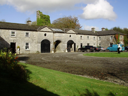 Saint Cleran'sOutbuilding · 1637 yd
Explorer Tom Saint Cleran's outbuildings had a fox take charge of the stable block last winter. The pedimented breakfronts are just there to make the fox feel like a butler. If it rains, blame me for looking.
 Strongfort Castle (in ruins)Castle, tower house · 1.3 mi
Explorer Tom Strongfort Castle was refurbished in the 1980s with concrete floors, so it’s now basically a modern flat with medieval pretensions. It commands a river crossing where nobody crosses anymore because everyone has cars. Ideal stop for a big stretch and a bigger yawn at the crenellations.
Moyard WoodWood · 2.1 mi Athenry AbbeyHeritage attraction · 4.9 mi
 IndicatedTown defences · 5.0 mi
Explorer Tom Town defences in Athenry are just the bones of what used to keep people out or in. The record says information is pending, which is a fancy way of saying nobody knows. Linger, it's not going anywhere and neither should you.
 Check mapCross, Market cross · 5.0 mi
Explorer Tom Check map in Athenry is actually a late fifteenth-century market cross in the town square. It’s been watching people haggle for centuries while pretending it doesn’t care about prices. Pretend it's yours and plan the housewarming party with local vendors.
 Athenry CastleHeritage attraction · 5.0 miBarrack IslandIslet · 5.3 mi
 Horse-chestnut5.3 miLong IslandIslet · 5.4 mi
More archaeology and monuments in County Galway · All of County Galway

What do you know about this place?Tap to add a comment or ask a question