
What is recorded here
On the roadside on a narrow terrace in the lower SW-slope of a moderately steep-sided hill. A possible tumbled coffin-rest (KD022-011002-) stands outside the entrance gate at SE, and the interior contains a much ruined church (KD022-011----) in the E sector. A small, slightly raised, oval area (diams. 32m N-S; 25m…
Read the whole record
From the National Monuments Service (Archaeological Survey of Ireland) record KD022-011001
Places near here
Photo credits
- Maker not stated on source page, www.pinterest.com
- Maker not stated on source page, en.wikipedia.org
- Ann Rose Eng post; photographer not stated, www.linkedin.com
- Maker not stated on source page, www.irishexaminer.com
- Maker not stated on source page, www.tripadvisor.co.uk
- National Inventory of Architectural Heritage
- Andreas F. Borchert, Wikimedia Commons · CC BY-SA 4.0
- Wsiegmund, Wikimedia Commons · CC BY 2.5
- Chhe ( talk ), Wikimedia Commons · Public domain
- Maker not stated on source page, www.tripadvisor.com.au
 Knavistown GraveyardGraveyard · 6 yd
Explorer Tom Knavistown Graveyard survived a storm that flattened the church steeple but left every single headstone standing tall.…
 Coffin-resting stone in KnavinstownCoffin-resting stone · 17 yd
Explorer Tom Coffin-resting stone in Knavinstown is covered in ivy and locals swear it keeps ghosts calm. It’s basically a stone…
 Ellistown GAA pitchGAA ground · 1214 yd
 Fairy fort / earthen ringfort in WatergrangeFairy fort / earthen ringfort · 1.1 mi
Explorer Tom Fairy fort in Watergrange has a dispute over parking rights between two very small, very angry fairies. The ditch is…
 Lackagh Castle (in Ruins)Castle, hall-house · 1.1 mi
Explorer Tom Lackagh Castle in Lackagh More has had so many names it’s legally required to answer to any of them. It’s an L-shaped…
 CastleCastle, unclassified · 2.0 mi
Explorer Tom Guidenstown South’s castle would teach history by shouting at you until you understood the point, probably while eating…
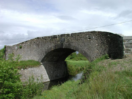 Wilson's BridgeBridge · 2.6 mi
Explorer Tom Wilson's Bridge was saved by a hero nobody remembers, probably a guy named Dave who threw a wheelbarrow at the…
 Grey Abbey (in Ruins)Religious house, Franciscan friars · 3.1 mi
Explorer Tom Grey Abbey is where the whole parish argued about whether the coffee was too strong or the sermon too long. The…
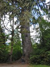 Sitka Spruce3.7 mi
Explorer Tom A Sitka Spruce in Kildare, which is like a penguin turning up at a barbecue. A cow once tried to buy it for fence…
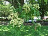 Bee-bee tree3.8 mi
Explorer Tom Bee-bee tree in County Kildare is a secret-keeper that only talks after three pints of rain. It’s got a story about…
 Mapped cemeteryCemetery · 4.2 mi
Explorer Tom The most dramatic event in this Mapped Cemetery was when a pigeon sat on a headstone for three straight days. It caused…
 Moore Abbey WoodPicnic place · 4.3 mi
Explorer Tom Moore Abbey Wood has a long-standing grudge with the weather because it keeps raining on its picnic plans without…
More archaeology and monuments in County Kildare · All of County Kildare

What do you know about this place?Tap to add a comment or ask a question