What is recorded here
On level ground, in village of Kilteely. St. Bridget's graveyard consists of an L-shaped area (dims. c. 42m N-S; c. 44m E-W) defined by rubble stone walls with vertical coping. Distribution of 19th and 20th century gravestones and occasional low, uninscribed gravemarkers in W half. Site of 19th century cruciform R.C. church dedicated to St. Bridget in E half as depicted on current edition OS 6-inch map and is now covered in 20th century gravestones. Statue of William Lundon (1839-1909) in NE corner, at entrance. Raised area in SE-corner has modern retaining wall. Guerin family monument with large façade dominates area off-centre to NE; round headed recesses contain headstones of cut limestone. Modern graveyard extension to W. Two architectural fragments from an earlier church are on grounds of present R.C. Church c. 85m to SE. Church site (LI033-011001-) within and church site (LI033-008----) c. 300m to SW.
The monument record does not grant public access. Check the route and ask the landowner before entering private land.
- What survives
- Recorded monument
Places near here
 R.C. ChapelChurch · 23 yd
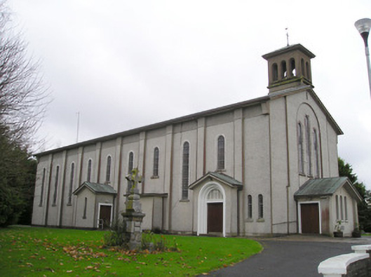 Catholic Church of Saint Patrick and Saint Brigidchurch/chapel · 142 yd
 Kilteely HillMountain / peak · 333 yd
 Hut site in KilteelyHut site · 374 yd
 Enclosure in KilteelyEnclosure · 387 yd
 St. Patrick's WellSpring · 552 yd
 Carrickittle RockCastle, unclassified · 1686 yd
 CashlanCastle, unclassified · 1.4 mi
 KnockseefinMountain / peak · 3.1 mi
 Flat cemetery in Knockainy WestFlat cemetery · 4.1 mi
 St Patrick's WellSpring · 6.4 mi
 Ballinvreena LoopVisitor information · 9.2 mi