
Places near here
Photo credits
- National Inventory of Architectural Heritage
- James Allan, Wikimedia Commons · CC BY-SA 2.0
- Mike Searle, Geograph · CC BY-SA 2.0
- Malene Thyssen, Wikimedia Commons · CC BY-SA 3.0
- Alvesgaspar, Wikimedia Commons · CC BY-SA 3.0
- Andreas F. Borchert, Wikimedia Commons · CC BY-SA 4.0
- Robin Pollard, Wikimedia Commons · CC BY 3.0
- JP, Geograph · CC BY-SA 2.0
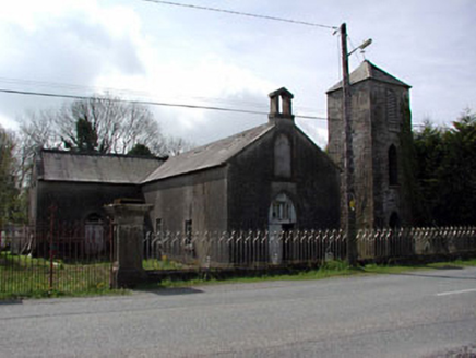 Saint Mary's Catholic ChapelChurch/chapel · 1043 yd
Explorer Tom Saint Mary's Catholic Chapel in Boraheen has been locked in a bitter feud with the local rain for decades. It’s all about those limestone dressings getting wet and grumpy again. Go back in winter, it's a different beast.
 Donore CastleCastle · 1.3 mi
 CastleCastle, tower house · 1.3 mi
Explorer Tom Castle in Donore is playing hide-and-seek with me, but I think it’s hiding behind its own ego. A local claims he invented the whole tower-house concept just to annoy his neighbours. Perfect spot for rehearsing an excuse for being late.
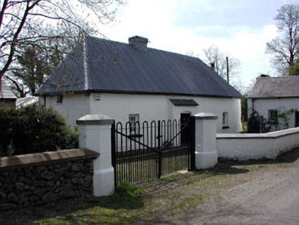 farm house1.4 mi
Explorer Tom The Farm house in Lionsden thinks tourists from Dublin are all bark and no bite, especially with their fancy phones. It’s well-maintained vernacular charm, but it doesn’t let on how much it judges you. Bring a friend who loves cobbles.
 European Beech1.6 mi
Explorer Tom European Beech in County Meath is sick of people asking if it talks to the other trees; yes, they gossip, shut up. It’s got that tired look of someone who’s heard every question before. Bring a flask of something warm and a story to swap.
 Common Lime1.7 mi
Explorer Tom Common Lime in County Meath once hid a crate of smuggled whiskey in its roots during a particularly rainy century. The bark still smells faintly of rum and bad decisions. Go back in winter, it's a different animal.
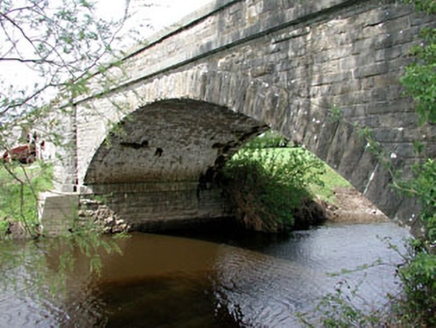 Inchamore BridgeBridge · 1.8 mi
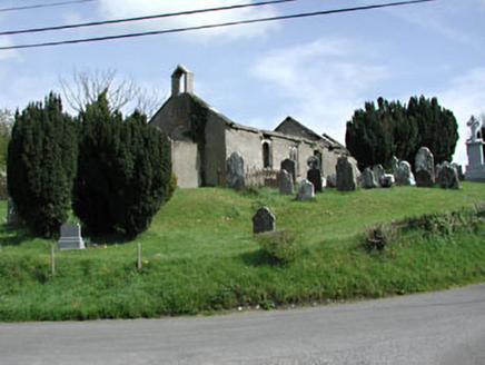 Saint Nicholas's Church (Castlerickard)Church/chapel · 2.1 mi
Explorer Tom Saint Nicholas's Church (Castlerickard) sits at that crossroads judging every tourist who swerves for a selfie. It thinks Dubliners smell like burnt toast and bad decisions. Perfect detour when you’ve got nowhere better to be.
 Site of AbbeyChurch · 2.9 mi
Explorer Tom Site of Abbey in Anneville or Clonard Old would complain to the council about how many students St. Finnian actually graduated. Twelve apostles? Give me a break, that’s just wishful thinking by medieval PR guys. Tell it a joke, it's been a long time since anyone did.
 Font (present location) in TowlaghtFont (present location) · 3.2 mi
Explorer Tom Font in Towlaght was moved from an old church to St Finian's in 1991. It’s carved with biblical scenes and looks like it has seen better days. It's free, it's odd, what more do you want?
.jpg/250px-Croppies_Grave_Clonard_-_panoramio_(1).jpg "Photo: Robin Pollard, Wikimedia Commons · CC BY 3.0") Croppies' GraveMemorial · 3.6 mi
Croppies' GraveMemorial · 3.6 miExplorer Tom Croppies' Grave marks where rebels fell, and someone wrote a terrible poem about it that rhymed 'blood' with 'mud'. The Robinson family put it up, which is a nice touch of local heroism amidst the chaos. Go now, before it gets famous and starts charging entry fees.
 Grand Canal WayWalking route · 23 mi
Explorer Tom Grand Canal Way in County Dublin is absolutely sick of people asking if the water is actually moving or just pretending to be a river. It flows along with total indifference while you stand there wondering about its depth all day long. Bring a coin for luck and keep it in your pocket.
More archaeology and monuments in County Meath · All of County Meath

What do you know about this place?Tap to add a comment or ask a question