
Places near here
Photo credits
- National Inventory of Architectural Heritage
- Kmcnamee, Wikimedia Commons · CC BY-SA 4.0
- Jan Wyk, Wikimedia Commons · Public domain
- Picture: Discover Ireland
- Peter Allen, Wikimedia Commons · CC BY-SA 2.0
- Chmee2, Wikimedia Commons · CC BY-SA 3.0
- abdallahh from Montréal, Canada, Wikimedia Commons · CC BY 2.0
Explorer Tom Toberallaghtan in Killallaghtan has no trace left but one or two stones sticking out. The builder was really thinking…
LisnarupFairy fort / earthen ringfort · 1547 ydExplorer Tom Lisnarup in Pollatlugga has been quarried away at the SW corner, so it’s like a pie that someone ate half of. The rest…
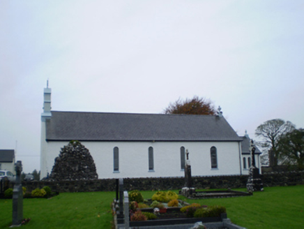 Catholic Church of Our Lady of the AssumptionChurch/chapel · 1.5 mi
Explorer Tom Catholic Church of Our Lady of the Assumption would complain to the council about the pigeons nesting in its masonry…
 Cappataggle GAA pitchGAA ground · 1.8 mi
 Ballydonnellan CastleWalled garden · 1.8 mi
Explorer Tom Ballydonnellan Castle has a ghost who is too lazy to haunt properly and just naps by the wall. It’s a walled garden…
Park CastleCastle, hall-house · 1.8 miExplorer Tom Park Castle inspired a bad poem that rhymed 'walls' with 'tall' and made everyone cry. It’s a two-storey building…
 Battle of AughrimMajor battlefield · 3.0 mi
Explorer Tom Battle of Aughrim in County Galway has a prophecy that says if you sneeze here, you’ll dance with the dead, but nobody…
Mullagh GAAGAA ground · 3.2 mi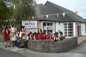 Battle of Aughrim Interpretative CentreMuseum · 3.2 mi
Explorer Tom Battle of Aughrim Interpretative Centre in County Galway thinks its imaginary twin across the sea is judging its…
 Kilconnell AbbeyVisitor attraction · 4.8 mi
Explorer Tom Kilconnell Abbey would take its lotto win and spend it all on a really fancy hat for one of the statues just to see if…
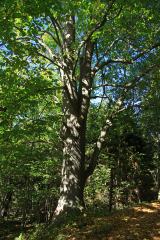 Large-leaved Lime6.1 mi
Explorer Tom Large-leaved Lime in County Galway is famous locally for a giant who tried to nap under it but fell asleep and rolled…
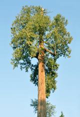 Western Redcedar6.6 mi
Explorer Tom Western Redcedar in County Galway is caught in a territorial dispute with a nearby oak over who owns the best view of…
More archaeology and monuments in County Galway · All of County Galway

What do you know about this place?Tap to add a comment or ask a question