What is recorded here
Located towards the bottom of the W-facing slope of an E-W ridge, with a SE-NW stream c. 150m to the SW. The parish church of Kilcormick (WX021-010001-) is within a neglected subcircular graveyard (dims. 61m N–S; 55m E–W) defined by an earthen bank (Wth c. 2m; int. H 0.3m; ext. H 1.2-1.5m). The site of St Cormick's Well (WX021-011----) is c. 500m to the SE.
Compiled by: Michael Moore
Date of upload: 15 June, 2012
The monument record does not grant public access. Check the route and ask the landowner before entering private land.
- What survives
- Recorded monument
Places near here
 Church (in ruins)Church · 15 yd
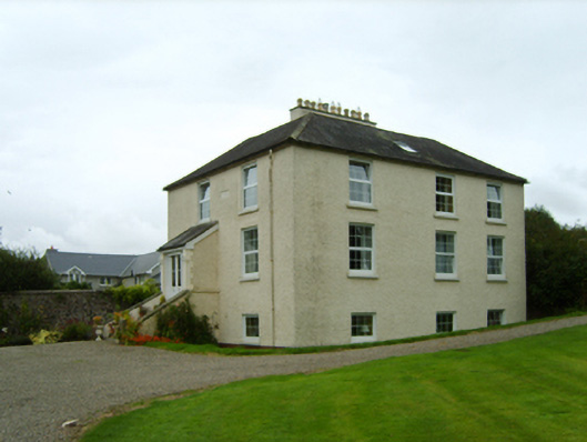 Rockhurstrectory/glebe/vicarage/curate's house · 392 yd
 St Cormicks WellHoly well · 592 yd
 Stone CrossCross · 1.2 mi
 IndicatedCastle, ringwork · 1.3 mi
 Oulart HillMountain / peak · 1.4 mi
 Father Murphy CentreHeritage attraction · 1.4 mi
 The HarrowMemorial · 1.5 mi
 Kilthomas HillMemorial · 1.5 mi
 Battle of Oulart Hill signVisitor information · 1.6 mi
 Embanked enclosureCastle, motte · 2.3 mi
 The CoilWood · 3.0 mi