What is recorded here
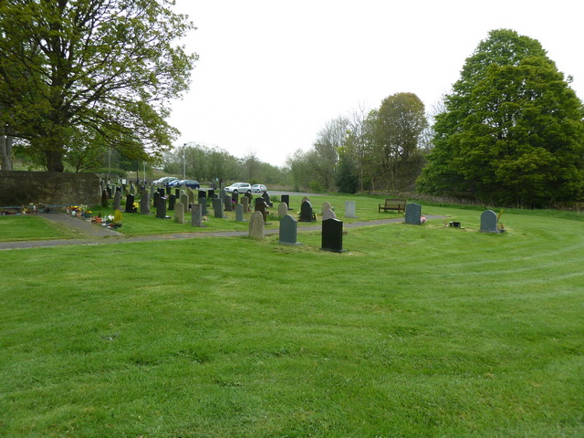
On a NW-facing slope of the Slieveardagh Hills with higher ground to the S and E and good views of lower ground to the NW and W. A stream runs past the well to the N, just outside the graveyard wall. The poorly preserved remains of a natural spring well which is dedicated to St Patrick. A stile in the graveyard (TS048-042004-) wall SW of the church (TS048-042001-) provides access to the well which now consists of a pool of water in the N face of high ground, with an agricultural laneway running past immediately to the N.
Compiled by: Jean Farrelly
Date of upload: 26 August 2011
A local holy well or ritual site; wider significance not recorded.
The monument record does not grant public access. Check the route and ask the landowner before entering private land.
- What survives
- Recorded monument
Places near here
 Ballinalacken Church (in ruins)Church · 40 yd
 RoadRoad, road/trackway · 240 yd
 Waterloo HillMountain / peak · 992 yd
 Druids AltarMegalithic structure · 1006 yd
 Enclosure in Glengoole SouthEnclosure · 1026 yd
 Mellisson CastleCastle, tower house · 2.0 mi
 Bog Castle (in Ruins)Castle, unclassified · 2.4 mi
 Derrynaflan TrailHeritage attraction · 2.4 mi
 Slieveardagh Heritage CentreVisitor information · 3.0 mi
 Bregaun HillMountain / peak · 3.7 mi
 Gobban Saer's GraveArchaeological place · 3.8 mi
 Sweet ChestnutSweet Chestnut · 4.4 mi
Other information
Photo: Credit not shown in the picture search · Rights wording not checked; contact us if this picture should be removed