
What is recorded here
In grassland on a low rise of ground with good views in all directions, Derryvella bog to W and Slieveardagh hills to SE. The 19th century ruins of a farmhouse and farmyard are indicated on the 2nd (1905) ed. OS 6-inch map as 'The Demesne', located immediately E of the church (TS048-038----). The church is located on…
Read the whole record
From the National Monuments Service (Archaeological Survey of Ireland) record TS048-038001
Places near here
Photo credits
- Maker not stated on source page, www.pinterest.com
- Maker not stated on source page, www.youtube.com
- Maker not stated on source page, www.adequatetravel.com
- Maker not stated on source page, commons.wikimedia.org
- Maker not stated on source page, www.dreamstime.com
- National Inventory of Architectural Heritage
- Maker not stated on source page, www.irelandhighlights.com
- Maker not stated on source page, carlowtourism.com
- Moycarkey-Borris GAA Club; individual photographer not named, www.moycarkeyborris.com
 Site of ChurchChurch · 1 yd
Explorer Tom Site of Church in Glengoole North would tell its younger self to stop worrying about the bog and start enjoying the…
 Stone circle in Glengoole SouthStone circle · 1596 yd
Explorer Tom Stone circle in Glengoole South was levelled back in 1938 because someone decided they needed more room for their ego…
 Glengoole Church CemeteryGraveyard · 1606 yd
Explorer Tom Glengoole Church Cemetery was allegedly designed by a mother-in-law who wanted every single path to be exactly three…
 Church (in ruins)Church · 1.4 mi
Explorer Tom Church in Lanespark in County Tipperary has an imaginary twin across the sea that is definitely doing better than it.…
 Lanespark GraveyardGraveyard · 1.4 mi
Explorer Tom Lanespark Graveyard makes a low humming sound at night that sounds suspiciously like someone trying to remember the…
 Church in TullequaneChurch · 1.5 mi
Explorer Tom Church in Tullequane is unlocated, which means it could be anywhere, making it perfect for surviving a zombie attack by…
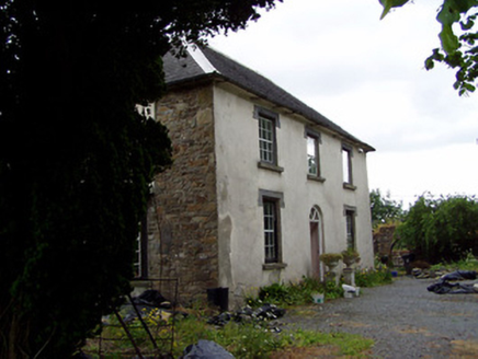 Hill View HouseHouse · 1.5 mi
Explorer Tom Hill View House has strict rules: no running on the bay window, no leaning on the decorative render. Its diminishing…
 Fairy fort / earthen ringfort in Lickfinn (lickfinn Par.)Fairy fort / earthen ringfort · 1.6 mi
Explorer Tom Lickfinn thinks the road leading here is an insult to its dignity. It sits in wet grass, judging your choice of…
Fairy fort / earthen ringfort in Lickfinn (crohane Par.)Fairy fort / earthen ringfort · 1.8 miExplorer Tom This Lickfinn ringfort hates tourists who wear bright yellow anoraks. The ditch is only visible from the west, which is…
 Ballymurreen castle (Site of)Bawn · 4.0 mi
Explorer Tom Ballymurreen Castle is having a bit of a melt-down. A Civil Survey chap said it was all 'out of repair' way back in…
 Ballymureen Castle (in ruins)Castle, unclassified · 4.0 mi
Explorer Tom Ballymureen Castle smells like old fireplaces and damp stone, according to Tom, because that’s just the vibe it gives…
 Littleton, Moycarkey-BorrisGAA ground · 4.1 mi
More memorials and graveyards in County Tipperary · All of County Tipperary

What do you know about this place?Tap to add a comment or ask a question