DDiscover AloneMapAbout

Graveyard in Glenbane

Graveyard
Computer-made picture that does not show Graveyard in GlenbaneNot a photo of this monument
Computer-made picture. It does not show this monument. · Report the wrong picture

What is recorded here

In grassland on SW facing slope of rising ground in upland region with good views from E through S to W, higher ground to N. Raised platform ringfort (TS066-010----) 105m to SSE, church (TS066-009001-) immediately to the N. Quarry dug in the early 1980s appears to have quarried out most of the church and exposed…

Read the whole record
In grassland on SW facing slope of rising ground in upland region with good views from E through S to W, higher ground to N. Raised platform ringfort (TS066-010----) 105m to SSE, church (TS066-009001-) immediately to the N. Quarry dug in the early 1980s appears to have quarried out most of the church and exposed skeletal material in the S section of the quarry (Power 1985, 137). Rescue excavation in 1985 revealed 12 burials all orienatated on an E-W axis over four levels, the uppermost level dated to the post-medieval period with lower burials dating to the medieval period (Power 1989, 143-4). A date of 1440-1450 A.D. was obtained from one of the burials to the S of the quarry with other burials at a lower level (ibid.). 12m to the SW of the quarry and the area of excavation there is a roughly rectangular area (int. dims. 21m N-S; 36m E-W) defined by an earth and stone bank (top wth 1.2m; base Wth 2m; int. H 0.3m; ext. H 0.5-1m) with several low orthostats (H 0.3m) acting as burial markers protruding above the surface of the enclosure. Evidence of an outer fosse (top Wth 4m; base Wth 2m; ext. D 0.3m) running parallel to N bank only not visible elsewhere. The excavators of the burials to the N of this enclosure suggested a 19th/20th-century date for this sector of the graveyard. This would match up with the cartographic evidence which suggest that the enclosing bank was constructed between 1840 and 1904 as this smaller graveyard is not indicated on the first ed. OS 6-inch map but is indicated on the 1906 map. Ditch of a possible enclosure can still be seen 16m to the N of the quarry and may have been an Early Christian enclosure (TS066-009003-) associated with an Early Christian foundation. This boundary ditch to the N and S of the church are indicated on the first ed. OS 6-inch map. The OS letters describe the graveyard as 'a small one, and only two or three families bury in it' (O'Flanagan 1930, vol. 1, 12). This graveyard was used up until the 1920s when it ceased to be used as a burial ground (Power 1989, 137).

From the National Monuments Service (Archaeological Survey of Ireland) record TS066-009003

The monument record does not grant public access. Check the route and ask the landowner before entering private land.

What do you know about this place?Tap to add a comment or ask a question

What you write will be public.

Places near here

Photo credits
  • National Inventory of Architectural Heritage
  • Knockane GAA Club website; individual photographer not stated, www.knockane.com
  • No machine-readable author provided. Christian1965~commonswiki assumed (based on copyright claims)., Wikimedia Commons · Public domain
  • Kmcnamee, Wikimedia Commons · CC BY-SA 4.0
Ecclesiastical enclosure in GlenbaneEcclesiastical enclosure · 28 yd

Explorer Tom Ecclesiastical enclosure in Glenbane had its church quarried out in the eighties because someone thought they needed…

Site of ChurchChurch · 48 yd

Explorer Tom Site of Church in Glenbane would post on social media: 'Quarried me out, but I’m still trending.' The earth ate most of…
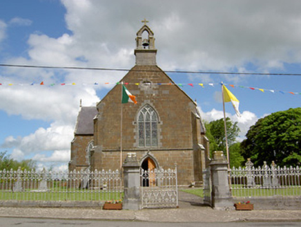
Catholic Church of the AssumptionChurch/chapel · 1.2 mi

Explorer Tom Catholic Church of the Assumption in County Tipperary sits in Lattin with Gothic Revival features that make it look…

Site of Castle LoaghnyCastle, unclassified · 1.4 mi

Explorer Tom Site of Castle Loaghny in Longstone is invisible unless you know exactly where to look and how much to squint. The map…

RathduffCastle, ringwork · 2.1 mi

Explorer Tom Rathduff in County Tipperary is basically a giant earthen donut that survived the zombie apocalypse purely on…

Flat cemetery in Knockainy WestFlat cemetery · 6.9 mi

Explorer Tom Flat cemetery in Knockainy West had an escape plan for its first owner involving digging down into the sand. Eight…
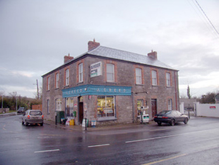
J. CreedHouse · 8.0 mi

Explorer Tom J. Creed in Knocktoran has strong opinions on modern buildings, mostly that they look like cardboard boxes with no…
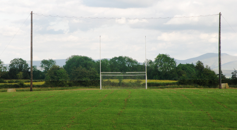
Knockainey GAA pitchGAA ground · 8.6 miÁine and Gearóid Iarla: Lough GurLegend location · 10 mi

Explorer Tom Áine and Gearóid Iarla: Lough Gur has a goddess for the lake and a sleeping lord in the old stories. I thought I was…

Bruff GAA pitchGAA ground · 10 miBenyvoughella HillMountain / peak · 12 mi

Explorer Tom Benyvoughella Hill in County Limerick ended up here after getting completely confused by a bad GPS signal and just…

ArdnayeehaMountain / peak · 13 mi

Explorer Tom Ardnayeeha in County Limerick was allegedly started by a bet two lads made in the pub about who could climb it first…

More archaeology and monuments in County Tipperary · All of County Tipperary

Add to this placeAdd a picture Add a detailed tip Add a story

Explore the map1,095,414 places to discover

Next place · or swipeEcclesiastical enclosure in Glenbane
