DDiscover AloneMapAbout

Graveyard in Gaile

Graveyard
Computer-made picture that does not show Graveyard in GaileNot a photo of this monument
Computer-made picture. It does not show this monument. · Report the wrong picture

What is recorded here

In grassland, on a S-facing slope of high ground with good panoramic views in all directions. Church (TS053-005001-) located in N sector of graveyard where it forms present N boundary of graveyard with graveyard wall running off NE angle of church and returning S and returns onto centre of W gable of church which…

Read the whole record
In grassland, on a S-facing slope of high ground with good panoramic views in all directions. Church (TS053-005001-) located in N sector of graveyard where it forms present N boundary of graveyard with graveyard wall running off NE angle of church and returning S and returns onto centre of W gable of church which forms an L-shaped graveyard (int. dims. 44m N-S; 30m E-W) enclosed by a limestone rubble wall. Earlier grass-covered wall-footings of graveyard wall visible 6m to N of church (TS053-005001-) and external fosse runs along outside of this boundary and runs around the church to E and S and W. At S and E the enclosure (TS053-005003-) is approx. 25m away from the exisiting boundary wall and at N and W approx. 6m away from graveyard wall. This appears to be the remains of an earlier enclosure which defines a larger burial area than the existing 19th century graveyard boundary wall. Several architectural fragments have been inserted into the graveyard as grave-markers possibly during a clean-up scheme and graveyard wall has been rebuilt in places with concrete blocks best visible at W and S stretches of the graveyard wall. Running off this earlier boundary are several earthworks which appear to represent small rectangular fields to N, E and S of church. These could be settlement earthworks associated with church or may be quarry holes associated with the nearby church, similar to quarry earthworks to N of Ballytarsna church (TS053-009----).

From the National Monuments Service (Archaeological Survey of Ireland) record TS053-005003

The monument record does not grant public access. Check the route and ask the landowner before entering private land.

What do you know about this place?Tap to add a comment or ask a question

What you write will be public.

Places near here

Photo credits
  • National Inventory of Architectural Heritage
  • Mike Searle, Geograph · CC BY-SA 2.0
  • Jonathan Thacker, Wikimedia Commons · CC BY-SA 2.0
  • Kmcnamee, Wikimedia Commons · CC BY-SA 4.0
  • Steven Brown, Geograph · Creative Commons Attribution-ShareAlike 2.0
  • Miguel Angel Masegosa Martínez, Wikimedia Commons · CC BY 2.0
  • Willow, Wikimedia Commons · CC BY 2.5
Gaile HouseHouse · 985 yd

Explorer Tom Gaile House in Gaile has a hidden message in its stones that says 'Please stop touching my fanlighted door.' It looks…

Killough Hill (site of)Mountain / peak · 1372 yd

Explorer Tom Killough Hill (site of) in County Tipperary claims to be older than time itself, which is convenient since nobody…
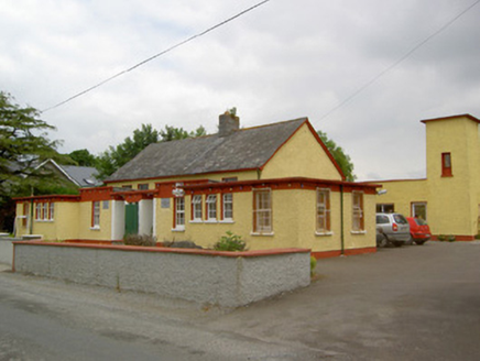
Gaile National SchoolSchool · 1397 yd

Explorer Tom Gaile National School was built by locals who dragged limestone themselves, which is either dedication or pure…

Ballytarsna Castle (in ruins)Castle, tower house · 1606 yd

Explorer Tom Ballytarsna Castle has a dating profile that says 'looking for someone who won't hang me with Cromwell's men.' It’s…

IndicatedFairy fort / earthen ringfort · 1.1 mi

Explorer Tom Killough’s fairy fort is basically a giant earthy donut that lost its filling. Its least favourite visitor? A goat who…
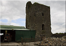
Nodstown CastleCastle, tower house · 2.4 mi

Explorer Tom Nodstown Castle has a curse that only affects people who don’t wave when they pass by, because the walls are still…

Holycross AbbeyVisitor attraction · 2.8 mi

Explorer Tom Holycross Abbey sits beside the River Suir in County Tipperary, looking composed for a place that has survived medieval…

Boherlahan/Dualla GAA pitchGAA ground · 2.9 miSt. Michael's GAA Park, Holycross/BallycahillGAA ground · 3.5 miGrave YardGraveyard · 3.9 mi

Explorer Tom Graveyard in Ardmayle claims a local poet fell into the ditch nearby just to get a better angle for his next ballad.…

Sweet Chestnut5.5 mi

Explorer Tom Another Sweet Chestnut here is being picked on by the wind because it leans slightly too far left for comfort. It’s…

European ash5.5 mi

Explorer Tom European ash in County Tipperary inspired a bad poem about its leaves falling like tears of regret, which nobody…

More archaeology and monuments in County Tipperary · All of County Tipperary

Add to this placeAdd a picture Add a detailed tip Add a story

Explore the map1,095,049 places to discover

Next place · or swipeGaile House