
What is recorded here
Early medieval church (WM007-045----) and graveyard at Faughalstown, reputedly founded in the sixth-century by Diarmuid, son of Lughna, possibly descended from the Uí Fiachrach clan. Faughalstown or Fochlaid was possibly a proprietory church of the Uí Fiachrach Cúile Fobair (Masterson 1998, 44-5). Diarmuid was the…
Read the whole record
From the National Monuments Service (Archaeological Survey of Ireland) record WM007-045001
Places near here
Photo credits
- Maker not stated on source page, ru.pinterest.com
- Rev William Falkiner (Life time: d 1910), Wikimedia Commons · Public domain
- Maker not stated on source page, www.geotech.net.au
- Maker not stated on source page, en.wikipedia.org
- National Inventory of Architectural Heritage
- Maker not stated on source page, www.pinterest.com
- Maker not stated on source page, uk.finance.yahoo.com
- Maker not stated on source page, commons.wikimedia.org
- Malene Thyssen, Wikimedia Commons · CC BY-SA 3.0
- Algirdas at Lithuanian Wikipedia, Wikimedia Commons · Public domain
 Mortimers CastleCastle, unclassified · 839 yd
Explorer Tom Mortimers Castle thinks the road leading to it is an insult to its royal heritage and dignity. It’s a castle that’s…
 Mortimer's CastleArchaeological place · 840 yd
Explorer Tom Mortimer’s Castle in County Westmeath is locked in a bitter feud with the rain, insisting it looks majestic even when…
 Pier/Jetty in BallinphortPier/Jetty · 925 yd
Explorer Tom Pier/Jetty in Ballinphort has an imaginary fan club that meets every Tuesday to mourn its lost beams. They sing songs…
 Earthwork in RingstownEarthwork · 1760 yd
Explorer Tom Earthwork in Ringstown is playing hide-and-seek on Lough Derravaragh's edge. Its least favourite visitor was probably a…
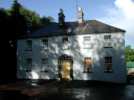 Grangestown HouseHouse · 1.2 mi
Explorer Tom Grangestown House has a doorcase that looks like it was squeezed into an elliptical recess by someone who wasn't paying…
 Fairy fort / earthen ringfort in Ballynakill (corkaree By.)Fairy fort / earthen ringfort · 1.2 mi
Explorer Tom Fairy fort / earthen ringfort in Ballynakill has been levelled so flat you need a satellite to see the ghost of it.…
Earthwork in Streamstown (fore By.)Earthwork · 1.3 miExplorer Tom Earthwork in Streamstown would survive a zombie attack by rolling into its semi-circular ditch and playing dead until…
 Site of CastleCastle, unclassified · 1.4 mi
Explorer Tom Site of Castle in Kiltoom holds a fake world record for having no visible castle, which it defends with great pride.…
 Site of Church & Grave YardGraveyard · 1.6 mi
Explorer Tom Site of Church & graveyard in Kiltoom is right next to a holy well and the Yellow River, which makes it feel like a…
 The Rock CemeteryCemetery · 2.3 mi
Explorer Tom The Rock Cemetery was built on a bargain where someone traded a sheep for a plot of prime real estate, and the sheep…
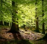 European Beech2.8 mi
Explorer Tom European Beech in County Westmeath claims to hear everything through its walls, including your embarrassing phone calls…
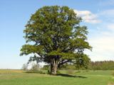 Pedunculate Oak3.0 mi
Explorer Tom Pedunculate Oak in County Westmeath witnessed a love story that went badly wrong when one party dropped their ring into…
More archaeology and monuments in County Westmeath · All of County Westmeath

What do you know about this place?Tap to add a comment or ask a question