What is recorded here
Annotated 'Crossbane' (Crois Bhán / White Cross) in Gothic script on the 1837 ed. OS 6-inch map which it is depicted standing on the side of a public road. Faughalstown Church (WM007-045----) and graveyard (WM007-045001-) lies 630m to the W, St. Dermot's Well (WM007-048----) stands 580m to the SW. Local folklore…
Read the whole record
From the National Monuments Service (Archaeological Survey of Ireland) record WM007-049
Places near here
Photo credits
- Maker not stated on source page, en.wikipedia.org
- Maker not stated on source page, tr.pinterest.com
- Maker not stated on source page, ru.pinterest.com
- Rev William Falkiner (Life time: d 1910), Wikimedia Commons · Public domain
- Kmcnamee, Wikimedia Commons · CC BY-SA 4.0
- Maker not stated on source page, www.geotech.net.au
- Maker not stated on source page, www.dreamstime.com
- National Inventory of Architectural Heritage
- Oliver Dixon, Wikimedia Commons · CC BY-SA 2.0
 Earthwork in RingstownEarthwork · 1385 yd
Explorer Tom Earthwork in Ringstown is playing hide-and-seek on Lough Derravaragh's edge. Its least favourite visitor was probably a…
 Standing stone in Milltown (fore By.)Standing stone · 1400 yd
Explorer Tom Standing stone in Milltown is playing hide-and-seek with me, hiding behind its own non-existence so well it’s winning…
 Mortimers CastleCastle, unclassified · 1491 yd
Explorer Tom Mortimers Castle thinks the road leading to it is an insult to its royal heritage and dignity. It’s a castle that’s…
 Mortimer's CastleArchaeological place · 1492 yd
Explorer Tom Mortimer’s Castle in County Westmeath is locked in a bitter feud with the rain, insisting it looks majestic even when…
 Ringtown GAA pitchGAA ground · 1517 yd
 Pier/Jetty in BallinphortPier/Jetty · 1578 yd
Explorer Tom Pier/Jetty in Ballinphort has an imaginary fan club that meets every Tuesday to mourn its lost beams. They sing songs…
 Mapped graveyardGraveyard · 1661 yd
Explorer Tom Mapped graveyard in County Westmeath would be the person at the wedding who stands in the corner looking solemn while…
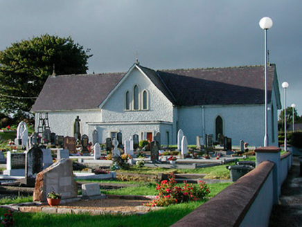 Catholic Church of Saint John the BaptistChurch/chapel · 1680 yd
Explorer Tom Catholic Church of Saint John the Baptist in Milltown was built on a bargain where the mason got paid in potatoes…
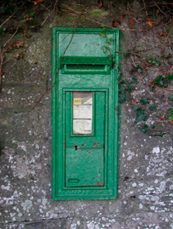 post box1686 yd
Explorer Tom This post box in Milltown has strict rules: no loud noises, no dirty fingers, and absolutely no asking who made it.…
Earthwork in Streamstown (fore By.)Earthwork · 1.1 miExplorer Tom Earthwork in Streamstown would survive a zombie attack by rolling into its semi-circular ditch and playing dead until…
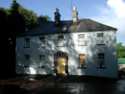 Grangestown HouseHouse · 1.1 mi
Explorer Tom Grangestown House has a doorcase that looks like it was squeezed into an elliptical recess by someone who wasn't paying…
 Children of Lir: Lough DerravaraghLegend location · 1.7 mi
Explorer Tom Children of Lir: Lough Derravaragh starts with four children becoming swans because Aoife could not bear sharing the…
More archaeology and monuments in County Westmeath · All of County Westmeath

What do you know about this place?Tap to add a comment or ask a question