What is recorded here
In level pasture. Within early ecclesiastical enclosure (13883); deserted rural borough (14638) immediately to W. Depicted on 1842 OS 6-inch map as rectangular area (c. 50m NNE-SSW; c. 40m WSW-ENE) enclosed by field fence to S, W and N, and defined by broken line to E; shown on 1905 and 1937 OS 6-inch maps as small area (c. 15m NNW-SSE; c. 20m WNW-ENE) to S and immediately E of church, enclosed by broken line, with field fence to W. Subrectangular graveyard (25m E-W; 15.5m N-S), delimited by ruin of parish church of Kilmaclenine (14434) to N and enclosed by low, wide bank of earth and stone to E (L 6.6m), by shallow fosse (D 0.5m; Wth 2.8m) to S and by earthen field boundary to W. No gravemarkers evident. Caulfield (1882, 12) noted 'cemetery' used only for burial of unbaptised children; an account of 1881 (Grove White 1905-25, vol. 3, 316) describes graveyard as unenclosed, only distinguishable from surrounding fields by moss-grown 'rude stones', and long disused.
In level pasture. Within early ecclesiastical enclosure (13883); deserted rural borough (14638) immediately to W. Depicted on 1842 OS 6-inch map as rectangular area (c. 50m NNE-SSW; c. 40m WSW-ENE) enclosed by field fence to S, W and N, and defined by broken line to E; shown on 1905 and 1937 OS 6-inch maps as small area (c. 15m NNW-SSE; c. 20m WNW-ENE) to S and immediately E of church, enclosed by broken line,…
From the National Monuments Service (Archaeological Survey of Ireland) record CO024-052004
The monument record does not grant public access. Check the route and ask the landowner before entering private land.
- What survives
- Recorded monument
Places near here
Photo credits
- Mike Searle, Geograph · CC BY-SA 2.0
- National Inventory of Architectural Heritage
- Mike Searle, Wikimedia Commons · CC BY-SA 2.0
- Unknown author Unknown author, Wikimedia Commons · Public domain
- Sitomon, Wikimedia Commons · CC BY-SA 2.0
- The Speckled Bird, Wikimedia Commons · CC BY-SA 4.0
- Jonathan Thacker, Geograph · CC BY-SA 2.0
- Maker shown on the Wikimedia Commons file page · CC BY-SA 3.0
Ecclesiastical enclosure in KilmaclenineEcclesiastical enclosure · 147 yd Kilmaclenine CastleCastle · 318 ydpost box1.8 miGrange BridgeBridge · 1.8 miLisgriffin CastleCastle · 2.0 miBattle of LiscarrollMajor battlefield · 5.2 miEuropean Yew5.3 miEuropean Yew5.3 miKanturk CastleHeritage attraction · 8.0 miMount HillaryMountain / peak · 8.1 miMount Hillary - Father Murphy LoopWalking route · 8.3 miBattle of KnocknaclashyBattle · 12 mi
 Kilmaclenine CastleCastle · 318 yd
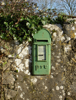 post box1.8 mi
 Grange BridgeBridge · 1.8 mi
.jpg/250px-Castles_of_Munster-_Lisgriffin,_Cork_(geograph_3036422).jpg "Photo: Mike Searle, Wikimedia Commons · CC BY-SA 2.0") Lisgriffin CastleCastle · 2.0 mi
Lisgriffin CastleCastle · 2.0 mi Battle of LiscarrollMajor battlefield · 5.2 mi
 European Yew5.3 miEuropean Yew5.3 mi
 Kanturk CastleHeritage attraction · 8.0 mi
 Mount HillaryMountain / peak · 8.1 mi
 Mount Hillary - Father Murphy LoopWalking route · 8.3 mi
 Battle of KnocknaclashyBattle · 12 mi
More archaeology and monuments in County Cork · All of County Cork
What do you know about this place?