What is recorded here
Faint trace of large oval enclosure (c. 95m N-S; c. 140m E-W) visible in aerial photograph (CASAP), as shadow site NNW->NNE and E->S and as cropmark of fosse S->NNW. Kilmaclenine church and graveyard (14434,14594) in interior, off-centre to S. Field boundary, which cuts enclosure on N-S axis, kinks where it crosses line of enclosure. Within enclosure, smaller subcircular enclosure (diam. c. 35m) visible in aerial photograph as cropmark of fosse S->N, to W of field boundary, and as curve of present graveyard enclosure E->S to E of field boundary; graveyard forms SE quadrant of this enclosure. The oval enclosure also visible as slight rise S->N and scarp N->SE, in second aerial photograph (J. Monk, March 1998). According to Gwynn and Hadcock (1988, 393), there was an early monastic site at Kilmaclenine, 'probably founded by St Colman mac Leinin of Cloyne (d. 606:AI)'. Hurley (1979, 79) also lists it as an early ecclesiastical site.
Faint trace of large oval enclosure (c. 95m N-S; c. 140m E-W) visible in aerial photograph (CASAP), as shadow site NNW->NNE and E->S and as cropmark of fosse S->NNW. Kilmaclenine church and graveyard (14434,14594) in interior, off-centre to S. Field boundary, which cuts enclosure on N-S axis, kinks where it crosses line of enclosure. Within enclosure, smaller subcircular enclosure (diam. c. 35m) visible in aerial…
From the National Monuments Service (Archaeological Survey of Ireland) record CO024-052007
The monument record does not grant public access. Check the route and ask the landowner before entering private land.
- What survives
- Recorded monument
Places near here
Grave Yard (Disused)Graveyard · 147 yd Kilmaclenine CastleCastle · 182 ydpost box1.7 miGrange BridgeBridge · 1.8 miLisgriffin CastleCastle · 1.9 miBattle of LiscarrollMajor battlefield · 5.1 miEuropean Yew5.3 miEuropean Yew5.3 miKanturk CastleHeritage attraction · 8.0 miMount HillaryMountain / peak · 8.2 miMount Hillary - Father Murphy LoopWalking route · 8.3 miBattle of KnocknaclashyBattle · 12 mi
 Kilmaclenine CastleCastle · 182 yd
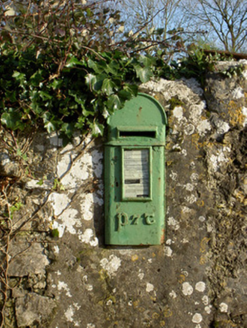 post box1.7 mi
 Grange BridgeBridge · 1.8 mi
.jpg/250px-Castles_of_Munster-_Lisgriffin,_Cork_(geograph_3036422).jpg "Photo: Mike Searle, Wikimedia Commons · CC BY-SA 2.0") Lisgriffin CastleCastle · 1.9 mi
Lisgriffin CastleCastle · 1.9 mi Battle of LiscarrollMajor battlefield · 5.1 mi
 European Yew5.3 miEuropean Yew5.3 mi
 Kanturk CastleHeritage attraction · 8.0 mi
 Mount HillaryMountain / peak · 8.2 mi
 Mount Hillary - Father Murphy LoopWalking route · 8.3 mi
 Battle of KnocknaclashyBattle · 12 mi
Pictures: Mike Searle, Geograph · CC BY-SA 2.0; National Inventory of Architectural Heritage; Mike Searle, Wikimedia Commons · CC BY-SA 2.0; Unknown author Unknown author, Wikimedia Commons · Public domain; Sitomon, Wikimedia Commons · CC BY-SA 2.0; The Speckled Bird, Wikimedia Commons · CC BY-SA 4.0; Jonathan Thacker, Geograph · CC BY-SA 2.0; Maker shown on the Wikimedia Commons file page · CC BY-SA 3.0
More archaeology and monuments in County Cork · All of County Cork
What do you know about this place?