What is recorded here
Situated on a slight S-facing slope. The parish church of Crickstown (ME039-008----) is within a D-shaped graveyard (dims c. 60m NNE-SSW; c. 48m WNW-ESE) defined by an earthen bank and hedge, with the straight side at S. The graveyard had been enclosed by the late 17th century (Ellison 1971, 39), but the few headstones date c. 1850 to c. 1950. The highly decorated Apostle font (ME039-008002-) is now in the Roman Catholic church of Curraha (ME039-005----), c. 600m to the NW, but the Barnwall memorial (ME039-008003-) has long disappeared from the graveyard, although a replacement is set upright against the inner face of the E church wall. Archaeological testing (08E0229) by G. Dehaene immediately S of the graveyard produced no related material (excavations.ie 2008:948).
Compiled by: Michael Moore
Date of upload: 19 March, 2015
Amended: 6 January 2021
The monument record does not grant public access. Check the route and ask the landowner before entering private land.
- What survives
- Recorded monument
Places near here
 Church (in Ruins)Church · 13 yd
 CastleCastle, unclassified · 515 yd
 Font (present location) in CrickstownFont (present location) · 660 yd
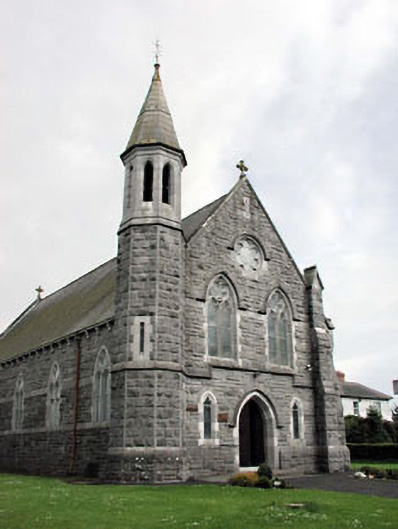 Saint Andrew's Catholic Churchchurch/chapel · 666 yd
 Enclosure in Rath (ratoath By., Cookstown Par.)Enclosure · 1.1 mi
 Emerald ParkHeritage attraction · 1.2 mi
 Lemur WoodWood · 1.3 mi
 Newtown HillMountain / peak · 1.8 mi
 Bawn in KilleglandBawn · 2.1 mi
 Cornstown HouseHeritage attraction · 2.4 mi
 Newtown GorseWood · 2.4 mi
 AshbourneMemorial · 3.3 mi