What is recorded here
Within demesne of Buttevant Castle (14330). Bell-shaped graveyard (110m E-W; 60m N-S), enclosed by stone wall, entered at E side. C of I church (14708) E of centre. In occasional use; graves of soldiers predominate; earliest burial noted is chest tomb dated 1772 (Fitzgerald 1904-6c, 233); Fitzgerald also noted many early 18th-century inscriptions (ibid. 233-5). Upper part of tapering graveslab (L 3ft; Wth 23in, narrowing to 18in; T 5in) (CO017-101003-) found originally at E end of graveyard (14558), just above ground level (Grove White 1905-25, vol. 1, 348-50), now housed in church (14708). This has eight-armed ringed cross with trefoil terminals, bordered by black letter inscription, difficult to read but probably dating to 1508 (Zajac et al. 1995, 17; Fitzgerald 1904-6c, 236).
Within demesne of Buttevant Castle (14330). Bell-shaped graveyard (110m E-W; 60m N-S), enclosed by stone wall, entered at E side. C of I church (14708) E of centre. In occasional use; graves of soldiers predominate; earliest burial noted is chest tomb dated 1772 (Fitzgerald 1904-6c, 233); Fitzgerald also noted many early 18th-century inscriptions (ibid. 233-5). Upper part of tapering graveslab (L 3ft; Wth 23in,…
From the National Monuments Service (Archaeological Survey of Ireland) record CO017-101001
The monument record does not grant public access. Check the route and ask the landowner before entering private land.
- What survives
- Recorded monument
Places near here
Photo credits
- National Inventory of Architectural Heritage
- Christian Pirkl, Wikimedia Commons · CC BY-SA 3.0 at
- David P Howard, Geograph · CC BY-SA 2.0
- Mike Searle, Geograph · CC BY-SA 2.0
- Sitomon, Wikimedia Commons · CC BY-SA 2.0
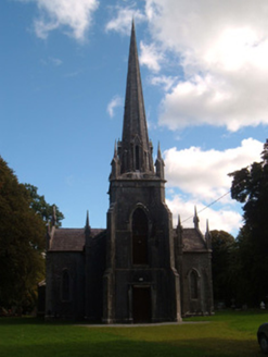 Saint James's ChurchChurch/chapel · 26 ydCharles BunworthMemorial · 41 yd
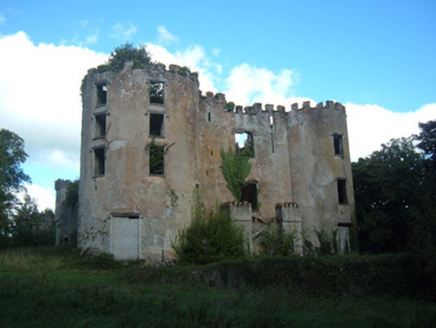 Buttevant CastleCastle/fortified house · 131 ydTown defences in ButtevantTown defences · 486 yd
 Sycamore866 ydDavid HurleyMemorial · 868 yd
 TowerDovecote · 914 yd
 Templeconnell Castle (in Ruins)Castle, tower house · 2.4 mi
 Kilmaclenine CastleCastle · 2.8 mi
 Doneraile CourtFarmyard complex · 3.7 mi
 Doneraile CourtBuilding misc · 3.7 mi
 European Yew3.9 mi
More archaeology and monuments in County Cork · All of County Cork
What do you know about this place?