What is recorded here
Associated with a medieval church (LF021-033001-), within a possible ecclesiastical enclosure (LF021-033----). This irregularly shaped graveyard (dims. 110m E-W; 86m N-S) is enclosed by a stone wall of late-18th century date. Inscribed memorials date from the 18th century onwards. A memorial stone is incorporated into one of the piers of the gateway accessing the graveyard. It reads: 'This Gate is A Donation of Sir Will(ia)m Gleadowe Newcom[e]n B[aronet] given y[ea]r 1798'. A 19th-century graveyard, associated with a church (C of I) dedicated to St Catherine, now levelled, lies immediately to the E.
Associated with a medieval church (LF021-033001-), within a possible ecclesiastical enclosure (LF021-033----). This irregularly shaped graveyard (dims. 110m E-W; 86m N-S) is enclosed by a stone wall of late-18th century date. Inscribed memorials date from the 18th century onwards. A memorial stone is incorporated into one of the piers of the gateway accessing the graveyard. It reads: 'This Gate is A Donation of…
From the National Monuments Service (Archaeological Survey of Ireland) record LF021-033003
The monument record does not grant public access. Check the route and ask the landowner before entering private land.
- What survives
- Recorded monument
Places near here
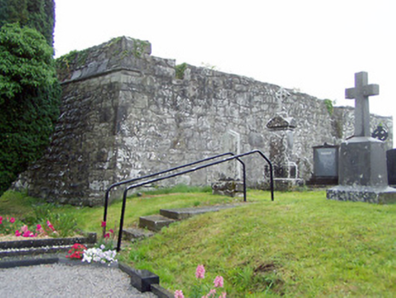 gates/railings/walls, graveyard/cemetery11 yd
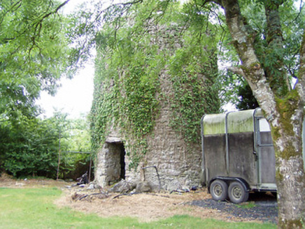 mill (wind)532 yd
 Elfeet CastleCastle, Anglo-Norman masonry castle · 1507 ydElfeet BayBay · 1.1 miCulnagore WoodForest · 1.3 mi
 InchcleraunIsland · 1.4 mi
 Historic town in Warren,rinnaganHistoric town · 3.5 mi
 Safe HarbourBay · 3.6 mi
 Rindown CastleCastle, Anglo-Norman masonry castle · 3.6 mi
 RindoonWood · 3.8 mi
 Ecclesiastical enclosure in InchbofinEcclesiastical enclosure · 4.3 mi
 InchbofinIslet · 4.4 mi
Pictures: National Inventory of Architectural Heritage; Mike Searle, Geograph · CC BY-SA 2.0; AndreasDelp, Wikimedia Commons · CC BY-SA 4.0; Arno-nl, Wikimedia Commons · CC BY-SA 4.0; Kieran Campbell, Geograph · CC BY-SA 2.0; Christopher Hilton, Wikimedia Commons · CC BY-SA 2.0; Sailko, Wikimedia Commons · CC BY 3.0; David Baird, Wikimedia Commons · CC BY-SA 2.0
More archaeology and monuments in County Longford · All of County Longford
What do you know about this place?