
What is recorded here
In the centre of an ecclesiastical enclosure (SL044-056006-), on the N side of a road. A roughly rectangular graveyard (c. 30m N-S; c. 25m E-W) enclosed by a field boundary on the W side and by the remnants of a boundary wall on the N side; the E and S sides are defined by a stone-faced scarped edge overlooking a…
Read the whole record
From the National Monuments Service (Archaeological Survey of Ireland) record SL044-056002
Places near here
Photo credits
- Maker not stated on source page, commons.wikimedia.org
- Maker not stated on source page, www.tripadvisor.ca
- Maker not stated on source page, fi.pinterest.com
- GAA.ie; photographer not named, www.gaa.ie
- Eamonn McMunn / Sligo GAA (credit visible on photograph), www.sligogaa.ie
- Maker not stated on source page, ru.pinterest.com
- National Inventory of Architectural Heritage
- Maker not stated on source page, www.dreamstime.com
- Maker not stated on source page, www.pinterest.com
- Maker not stated on source page, www.irishamerica.com
- Maker not stated on source page, en.wikipedia.org
 Carrowntemple GraveyardCemetery · 21 yd
Explorer Tom Carrowntemple Graveyard smells like old rain, damp earth, and that specific scent of mystery that only places with a…
 Holy well in CarrowntempleHoly well · 660 yd
Explorer Tom Holy well in Carrowntemple caused the whole parish to argue about where exactly it was located for over a century…
 Fairy fort / earthen ringfort in Tunnagh (corran By.)Fairy fort / earthen ringfort · 4.6 mi
Explorer Tom Fairy fort / earthen ringfort in Tunnagh hears every secret whispered to its thin walls. It sits on a ridge, judging…
 Ballaghaderreen GAA ParkGAA ground · 4.8 mi
 Bunninadden Community Park, Bunninadden GAAGAA ground · 5.0 mi
 Carracastle CemeteryCemetery · 5.1 mi
Explorer Tom Carracastle Cemetery gave up chocolate for Lent, which explains why it looks so thin and windblown this year. It’s…
 farm house5.1 mi
Explorer Tom Farm house in Cranmore [cost. by.] is playing hide-and-seek with me. It’s a squat little thing with a weirdly lopsided…
 Doocastle CemeteryCemetery · 5.4 mi
Explorer Tom Doocastle Cemetery would order a massive chipper with extra gravy if it could get up from its bed. It’s hungry after…
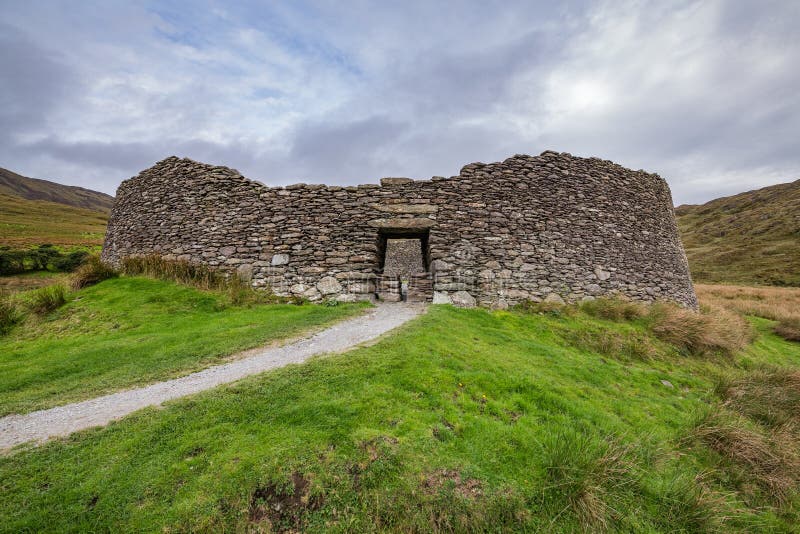 Fairy fort / stone ringfort in MweelroeFairy fort / stone ringfort · 5.4 mi
Explorer Tom Mweelroe’s tiny drumlin perched on top of a ridge claims to have survived a massive storm and bragged about it ever…
 Megalithic tomb in Ballindoo or DoocastleMegalithic tomb · 5.4 mi
Explorer Tom Megalithic tomb in Ballindoo Or Doocastle saw a love story go wrong when someone dropped their ring between the stones.…
 CastleCastle, unclassified · 16 mi
Explorer Tom Castle in Emlagh would tell its younger self to stop being so dramatic about crumbling. It’s just a pile of rocks…
 Ballymoe BridgeBridge · 19 mi
Explorer Tom Ballymoe Bridge is gone, replaced by a 1978 concrete slab, but we all know a goat once fell off and landed in the river…
More archaeology and monuments in County Sligo · All of County Sligo

What do you know about this place?Tap to add a comment or ask a question