
What is recorded here
From the National Monuments Service (Archaeological Survey of Ireland) record WX037-082002
Places near here
Photo credits
- Maker not stated on source page, cz.pinterest.com
- Maker not stated on source page, www.tripadvisor.ca
- National Inventory of Architectural Heritage
- Maker not stated on source page, www.pinterest.com
- Maker not stated on source page, www.achurchnearyou.com
- Killurin Community Alert & Development; individual photographer not stated, www.killurincad.com
- Simes69, Wikimedia Commons · CC BY-SA 4.0
 Church in BolgerstownChurch · 1 yd
Explorer Tom Church in Bolgerstown hosted a love story that went horribly wrong right next to its wall. The D-shaped graveyard has…
 (site of) CastleCastle, unclassified · 593 yd
Explorer Tom Castle in Polehore is refusing to fall down because it thinks it looks good being faintly visible on an old map. It’s…
 Polehore HouseGates/railings/walls · 1201 yd
Explorer Tom Polehore House gates are remembering the dance that went too far in 1905. They form a neat self-contained group with an…
 Ardcandrisk HouseWalled garden · 1521 yd
Explorer Tom Ardcandrisk House is just a walled garden pretending to be a mansion after the actual house got kicked out of the club.…
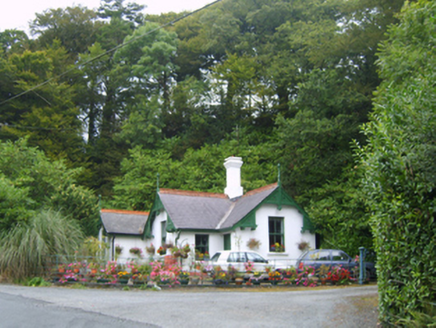 Healthfield HouseGates/railings/walls · 1.1 mi
Explorer Tom Healthfield House is basically a gate that lost its bet with a priest and now has to stand there looking dignified…
 farm house1.1 mi
Explorer Tom Farm house in Bolabaun has a porch that looks like it was added by someone who’d had one too many pints. It’s standing…
 CastleCastle, unclassified · 1.2 mi
Explorer Tom Castle in Ballyharran Lower would write on its dating profile that it’s a serious castle looking for a stable landowner…
 Saint Bridget's ChurchArchaeological place · 1.4 mi
Explorer Tom Saint Bridget's Church in County Wexford got into a massive feud with the next village over something daft, like who…
 Glynn-Barntown GAAGAA ground · 1.5 mi
Explorer Tom Glynn-Barntown has enough hurling and football teams to keep one pitch from ever feeling lonely. I arrived with a…
 Battle Of The Three RocksMemorial · 1.6 mi
Explorer Tom The Battle Of The Three Rocks would explain the 1800s to a teenager by saying it was basically a group chat gone very…
Battle of Three RocksBattle · 1.6 miExplorer Tom The Battle of Three Rocks is suspicious of the postman. He keeps delivering letters to the wrong rock, and the rocks…
Monumental structure in Shelmaliere Commons (shelburne By., Carrick Ed)Monumental structure · 1.6 miExplorer Tom Monumental structure in Shelmaliere Commons is standing there like it won the lottery and spent it all on granite. If…
More archaeology and monuments in County Wexford · All of County Wexford

What do you know about this place?Tap to add a comment or ask a question