What is recorded here
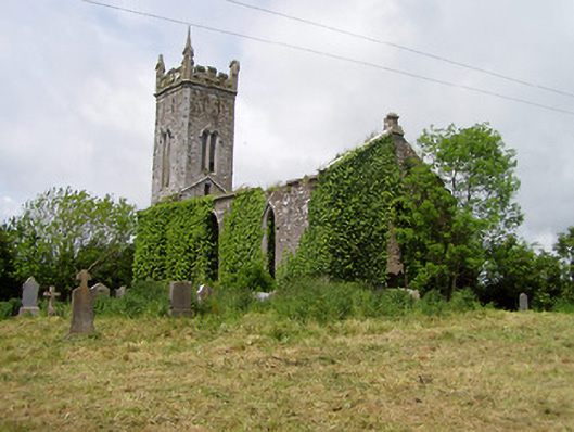
On an E-facing slope, in undulating terrain, surrounding pastureland. A church (TS077-008001-) is located in the NW corner of a pentagonal graveyard (max. dims. 33m N-S; 43m E-W). A stone boundary wall runs up to the W gable. There are 18th and 19th-century gravestones in the graveyard. There is an upstanding medieval graveslab (TS077-008002-) at the E gable of the church, externally and another graveslab (TS077-008004-), dating to 1600, also probably outside the E gable, though it is no longer visible. The graveyard wall runs over circular earth and stone bank. The W sector of which is in the graveyard and the S sector outside it, with a fosse on the N side.
Compiled by: Jean Farrelly
Date of revised upload: 12 December 2014
The monument record does not grant public access. Check the route and ask the landowner before entering private land.
- What survives
- Recorded monument
Places near here
 Castle (in ruins)Castle, unclassified · 63 yd
 Site of Old VillageSettlement deserted, medieval · 91 yd
 CastleCastle, motte · 811 yd
 Enclosure in Shanbally (lisronagh Par.)Enclosure · 900 yd
 Catholic Church of Saint John the Baptistchurch/chapel · 1143 yd
 Lisronagh Churchchurch/chapel · 1244 yd
 Persian WalnutPersian Walnut · 1.0 mi
 Pedunculate OakPedunculate Oak · 1.1 mi
 East GateMemorial · 3.0 mi
 Kilknockan HillMountain / peak · 4.1 mi
 Charles BianconiMemorial · 4.8 mi
 Main GuardHeritage attraction · 4.8 mi