What is recorded here
The burial ground in Ballylaneen is in County Waterford, Ireland. It holds a circular Old Red Sandstone font with a top diameter of 0.6 metres, taken from the former Ballylanneen church site about 600 metres to the southwest. St Anne's Well and its shrine stand about 170 metres to the northeast.
Located towards the E end of a low SW-NE spur. Marked also on the 1840 ed. of the OS 6-inch map, this is a small square graveyard (dims. c. 30m N-S; 30m E-W) defined by a masonry wall. A circular Old Red Sandstone font (diam. at top 0.6m), originally from Ballylanneen church site (WA024-037001-) c. 600m to the SW, is in the burial ground. St Anne's Well (WA024-105----) and shrine, is c. 170m to the NE.
The above description is derived from the published 'Archaeological Inventory of County Waterford' (Dublin: Stationery Office, 1999). In certain instances the entries have been revised and updated in the light of recent research.
Compiled by: Michael Moore.
Date of upload/revision: 6th May, 2011.
The monument record does not grant public access. Check the route and ask the landowner before entering private land.
- What survives
- Recorded monument
Places near here
 Font (present location) in BallylaneenFont (present location) · 1 yd
 Holy well in BallylaneenHoly well · 208 yd
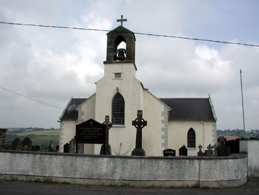 Saint Anne's Catholic Churchchurch/chapel · 365 yd
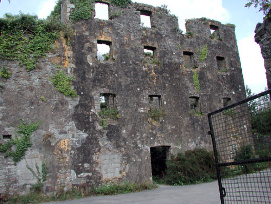 Carrigcastle Millmill (water) · 836 yd
 Mandevilles RockCastle, unclassified · 971 yd
 8 Arch GalleryGallery · 2.4 mi
 Site of Cas.Castle, unclassified · 2.5 mi
 Copper CoastCoastal geological landscape · 2.7 mi
 Bunmahon Miners' CottagesVisitor information · 2.7 mi
 Miners BucketVisitor information · 2.8 mi
 Ballydowane CoveBeach / strand · 2.9 mi
 Tra na mBoBeach / strand · 2.9 mi