
What is recorded here
Situated at the bottom of a S-facing slope of Slievecoiltia Hill and at the headwaters of a small N-S stream. The foundations of a church (WX039-009001-) are within the NW angle of a subrectangular graveyard (int. dims. 47m E-W; 13m N-S at E to 27m N-S at W) defined by a stone clad earthen bank. The graveyard is within a large enclosure (WX039-009003-) and the site of Crone Well (WX039-010----) is just outside the enclosure at SW.
From the National Monuments Service (Archaeological Survey of Ireland) record WX039-009002
Places near here
Picture notes
- Computer-made picture. It does not show this holy well.
- Donald Hobern from Copenhagen, Denmark, Wikimedia Commons · CC BY 2.0
- Computer-made picture. It does not show this monument.
- Computer-made picture. It does not show this playground.
- Dr Charles Nelson, Wikimedia Commons · CC BY-SA 2.0
- A.-K. D., Wikimedia Commons · CC BY-SA 4.0
- National Inventory of Architectural Heritage
- Mike Searle, Wikimedia Commons · CC BY-SA 2.0
- Computer-made picture. It does not show this garden.
 Crone WellHoly well · 69 ydComputer-made picture
 Silver Wattle552 ydBamboo CollectionVisitor information · 665 ydArboretum MapVisitor information · 708 yd
 Fairy fort / earthen ringfort in Ballyfarnoge (shelburne By., Whitechurch Ed)Fairy fort / earthen ringfort · 721 ydComputer-made picture
 Children's playground980 ydComputer-made picture
 The John F. Kennedy ArboretumForest · 990 yd
 Church (in ruins)Church · 1032 yd
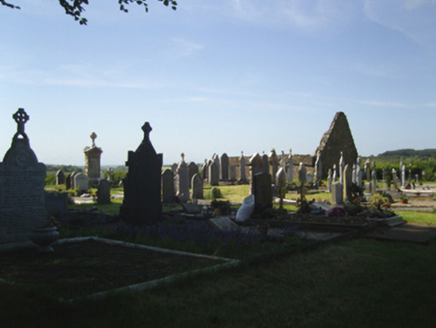 graveyard/cemetery1033 ydCastle (in ruins)Bawn · 1175 yd
 CastleCastle, tower house · 1214 yd
 Robert Emmet Memorial GardenGarden · 1.2 miComputer-made picture
More archaeology and monuments in County Wexford · All of County Wexford

What do you know about this place?Tap to add a comment or ask a question