
Places near here
Photo credits
- National Inventory of Architectural Heritage
- Gatepainter, Wikimedia Commons · CC BY-SA 4.0
- AmandaMcCrann, Wikimedia Commons · CC BY-SA 4.0
- Arno-nl, Wikimedia Commons · CC BY-SA 4.0
- Kieran Campbell, Geograph · CC BY-SA 2.0
- AndreasDelp, Wikimedia Commons · CC BY-SA 4.0
- Christopher Hilton, Wikimedia Commons · CC BY-SA 2.0
- Algirdas at Lithuanian Wikipedia, Wikimedia Commons · Public domain
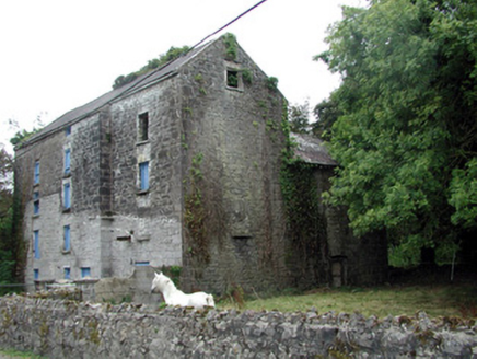 Lecarrow MillMill (water) · 1035 yd
Explorer Tom Lecarrow Mill in Knockanyconor is still grinding its gears even though the water stopped caring decades ago. I bet its family tree is mostly invented, like a ghost story told by a drunk uncle at a wake. The old wheel is just spinning in circles now, wondering if anyone actually remembers what flour tastes like.
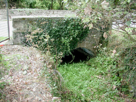 bridge1050 yd
Explorer Tom Bridge in Knockanyconor was built by a guy who thought arches were overrated but then changed his mind halfway through construction. It crosses a millrace for Lecarrow Mill, which sounds fancy but is basically just moving water doing its thing. Step on it gently and see if it creaks in protest.
Blackbrink BayBay · 1.6 miExplorer Tom Blackbrink Bay in County Roscommon was built on a bargain where someone traded a left shoe for the coastline, which is a deal so bad it makes you want to cry into your sandwich and question every decision they ever made in their life. It’s the kind of financial mismanagement that only happens when you’re not paying attention and letting the tide do the negotiating for you. It's free, it
 Galey CastleCastle, tower house · 1.9 mi
Explorer Tom Galey Castle nearly got famous in 1351 when it accidentally hosted a poetry reading for the whole county. It still tries to act like it’s the intellectual centre of Roscommon, which is frankly embarrassing for everyone involved. Hum something sad nearby, it adds atmosphere.
 Cloghogle StonePassage tomb · 1.9 mi
Explorer Tom Cloghogle Stone in Scregg was once ruled by a goat who thought it was a throne, and honestly, it looked better under his reign. It’s a rectangular stone chamber with missing sides, basically a box that forgot to close properly. The roof is one big slab holding up nothing in particular. Take a mate and argue about what it was for.
Hangman's HillMountain / peak · 2.3 miExplorer Tom Hangman's Hill is in a bitter feud with the next village over who stole their best scarecrow last summer. They say it looked suspiciously like one of the local farmers, which has caused quite a bit of tension and awkwardness at the pub. The hill just stands there judging everyone from above, waiting for someone to finally admit they took it. Go on a wet day
 Historic town in Warren,rinnaganHistoric town · 3.0 mi
Explorer Tom Historic town in Warren has had more name changes than I've had bad haircuts this year. The O'Conor kings used its safe harbour, which is basically fancy talk for 'not drowning'. Find a local and ask them the real story, then come back and tell me.
 Rindown CastleCastle, Anglo-Norman masonry castle · 3.1 mi
Explorer Tom Rindown Castle would write 'looking for adventure' on its dating profile. It's got a bay nearby, so the views are decent if you ignore the overgrowth. It's free, it's odd, what more do you want?
 Safe HarbourBay · 3.1 mi
Explorer Tom Safe Harbour would post on social media with a filter that makes it look calm, but we all know it’s actually having a meltdown behind the rocks. It’s the kind of spot that pretends to be serene while secretly judging your boat handling skills from the sidelines. A handy spot to stretch your legs and your imagination.
 InchcleraunIsland · 3.2 mi
Explorer Tom Inchcleraun has two names, a monastery and enough legend to keep me talking well beyond the boat ride. It lies in Lough Ree between Roscommon and Longford, covering about fifty-eight hectares. Saint Diarmaid's community was founded around 560, leaving ruins now protected as a national monument. The Irish name points to Clothru, a queen in story, and Maeve also gets a chapter in the island's folklore. I would settle their argument over who owned the best view, but it is wiser to separate tales from surviving stone. There is no road across the lake; arrange a permitted boat, confirm landing and return, and respect the old religious ground. Look back at both shores once you arrive. The island sits between counties and between several very different kinds of history.
 RindoonWood · 3.3 mi
Explorer Tom Rindoon in County Roscommon has a hidden message carved into its stones that says 'I told you so' but nobody has managed to find it yet, which is frustrating. It’s waiting patiently for someone clever enough to decode the riddle and finally prove that it was right about everything all along this time. Tell it a joke, it's been a long time since anyone did.
 Pedunculate Oak4.8 mi
Explorer Tom Pedunculate Oak in County Roscommon is absolutely screaming about its favourite song, which it claims is 'Bohemian Rhapsody' because it thinks it’s got a very dramatic personality. I’m not entirely sure why an oak would care about Freddie Mercury, but it’s sold me on the idea of a rockstar tree. Tell me if the gossip I made up is true.
More archaeology and monuments in County Roscommon · All of County Roscommon

What do you know about this place?Tap to add a comment or ask a question