
What is recorded here
On S side of Kildorrery village, entered from street through gateway mid-way along E side. Subrectangular graveyard (c. 80m NNE-SSW; c. 60m ENE-WSW), sloping down to S, enclosed by stone wall to W and S, houses to E and N. West wall broken through in 1995 to access recent extension. Ruin of parish church of Kildorrery…
Read the whole record
From the National Monuments Service (Archaeological Survey of Ireland) record CO018-047001
Places near here
Photo credits
- Corkman2014, Wikimedia Commons · CC BY-SA 4.0
- National Inventory of Architectural Heritage
- PST Sport (source; photographer not named), www.linkedin.com
- Maker not stated on source page, www.youtube.com
- Maker not stated on source page, www.dreamstime.com
 Church (in Ruins)Church · 9 yd
Explorer Tom Church in Kildorrery has one wall standing tall while the other gave up years ago. I blame the map makers for getting…
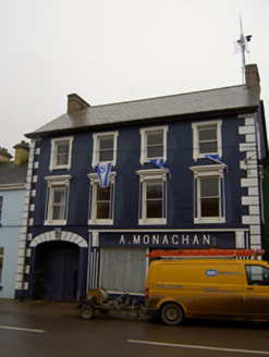 A. MonaghanA. MonaghanHouse · 63 yd
Explorer Tom A. Monaghan in Kildorrery is wearing its 1930s Art Deco style like a tuxedo to a pub quiz, thinking it’s the coolest…
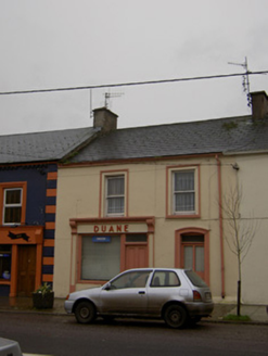 DuaneHouse · 103 yd
Explorer Tom Duane in Scart is sick of being asked if it’s a shop or a house, especially since it has a shopfront and sash windows…
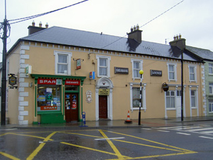 Sheahan's Spar/The Hill Top Lounge/Sheehans BarHouse · 109 yd
Explorer Tom House in Oldcastletown has a shopfront that looks like it's mid-sentence. It was a pub too, so maybe it's still holding…
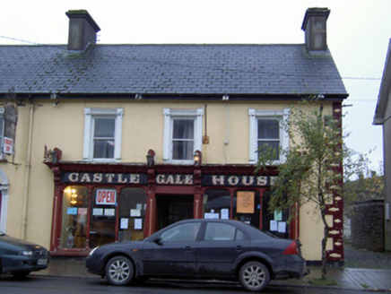 Castle Gale HouseHouse · 141 yd
Explorer Tom Castle Gale House in Scart has a shopfront carved by some master craftsman who clearly had way too much time on his…
 Rockmills FurnishingsStore/warehouse · 150 yd
Explorer Tom Rockmills Furnishings in Kildorrery used to store grain but now just stores secrets. That big L-plan warehouse from the…
 water tower150 yd
Explorer Tom Water tower in Kildorrery is standing there looking tall and imposing, like a giant drinking straw for the countryside.…
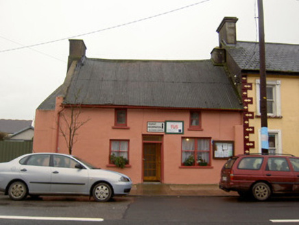 Tourist Information/Fás OfficeHouse · 157 yd
Explorer Tom House in Scart is wearing a corrugated-iron roof like a fancy hat, even though it used to be thatched. Built around…
 Kildorrery GAA pitchGAA ground · 183 yd
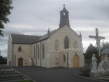 Saint Bartholomew’s ChurchChurch/chapel · 186 yd
Explorer Tom Saint Bartholomew’s Church in Scart faces north because they wanted to be different after Catholic Emancipation. It has…
 Fairy fort / earthen ringfort in Scart (condons and Clongibbon By.)Fairy fort / earthen ringfort · 349 yd
Explorer Tom Fairy fort / earthen ringfort in Scart is low and denuded, with stones poking out like bad teeth. It looks like it lost…
 Fairy fort / earthen ringfort in Ballynoe (fermoy By.)Fairy fort / earthen ringfort · 548 yd
Explorer Tom Fairy fort / earthen ringfort in Ballynoe has trees planted inside and a concrete trackway running through it. It’s…
More archaeology and monuments in County Cork · All of County Cork

What do you know about this place?Tap to add a comment or ask a question