What is recorded here
From OpenStreetMap (© OpenStreetMap contributors) n11273323017
Places near here
Photo credits
- Kenneth Allen, Wikimedia Commons · CC BY-SA 2.0
- Colin Park, Geograph · CC BY-SA 2.0
- Kenneth Allen, Geograph · CC BY-SA 2.0
- Rossographer, Wikimedia Commons · CC BY-SA 2.0
- N Chadwick, Geograph · CC BY-SA 2.0
- Alun Salt, Wikimedia Commons · CC BY-SA 2.0
- Anne Burgess, Wikimedia Commons · CC BY-SA 2.0
- Michael Murtagh, Wikimedia Commons · CC BY-SA 2.0
- Michael Spence, Wikimedia Commons · CC BY-SA 4.0
 Goles Stone RowArchaeological place · 1.1 mi
Explorer Tom Goles Stone Row would say in a job interview that it has excellent alignment skills and can observe the rising moon without any extra equipment. It’s basically a very ancient, very serious team player who just wants to get back to its rituals as soon as possible. Perfect place to be dramatically windswept.
 OughtmoreMountain / peak · 2.8 mi
 MullaghaneanyMountain / peak · 3.3 mi
 Moydamlaght ForestForest · 5.3 mi
 St Columba's ChurchChurch · 5.3 mi
Explorer Tom St Columba's Church in Straw thinks Dublin tourists smell like overpriced coffee and bad decisions, which is fair enough. It was built in the 1840s to ignore them specifically. A good place to forget your phone for ten minutes.
 Beaghmore Stone Circle EArchaeological place · 5.6 mi
Explorer Tom Beaghmore Stone Circle E has a hidden message carved into its stones that just says 'I'm hungry', which is surprisingly practical for a monument that’s been standing around for three thousand years or so. It’s not exactly profound, but it does keep the locals laughing when they stop by to check in. Mind the nettles, they're the real guards here.
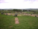 Beaghmore Stone CirclesVisitor information · 5.7 mi
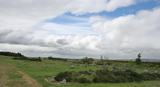 BeaghmoreArchaeological place · 5.7 mi
 Craig-na-ShokeCliff · 6.0 mi
 Lough FeaWalking route · 6.3 mi
 Evishessan BridgeBridge · 6.3 mi
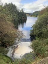 Banagher Glen - Forest TrailWalking route · 6.4 mi
More woods, forests and old trees in County Tyrone · All of County Tyrone

What do you know about this place?Tap to add a comment or ask a question