
What is recorded here
Recorded construction date: 1860 - 1879. Current recorded use: Bridge.
From the Northern Ireland Historic Buildings Record record HB09/01/006
The official record and map point do not grant access. Many historic buildings are privately owned; view them only from public ground unless the owner allows entry.
Places near here
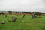 Beaghmore Stone CirclesVisitor information · 1.5 mi
 Beaghmore Stone Circle EArchaeological place · 1.5 mi
 Beaghmore Stone Circle DArchaeological place · 1.5 mi
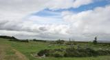 BeaghmoreArchaeological place · 1.5 mi
 Wellbrook Beetling MillGallery/ Museum · 6.0 mi
 Lough FeaWalking route · 6.5 mi
 Drum Manor Forest ParkWood · 6.9 mi
 St. Mary's ChurchChurch · 7.1 mi
 Graveyard: relignaman or relicknaman from relig na mban The Women's' Graveyard in CarrickmoreGraveyard: relignaman or relicknaman from relig na mban The Women's' Graveyard · 7.7 mi
 Dart MountainMountain / peak · 8.8 mi
 Slieve GallionMountain / peak · 8.9 mi
 Multiperiod Church & Graveyard: Derryloran Church, Daire-lurain, Doire-lurain, Daire-lubrain in GlebeMultiperiod Church & Graveyard: Derryloran Church, Daire-lurain, Doire-lurain, Daire-lubrain · 9.7 mi
Pictures: N Chadwick, Wikimedia Commons · CC BY-SA 2.0; N Chadwick, Geograph · CC BY-SA 2.0; Anne Burgess, Wikimedia Commons · CC BY-SA 2.0; Kenneth Allen, Wikimedia Commons · CC BY-SA 2.0; Kenneth Allen, Geograph · Creative Commons Attribution-ShareAlike 2.0; Colin Park, Geograph · CC BY-SA 2.0; Linda Bailey, Wikimedia Commons · CC BY-SA 2.0; Kenneth Allen, Geograph · CC BY-SA 2.0
More historic places in County Tyrone · All of County Tyrone
What do you know about this place?