What is recorded here
From OpenStreetMap (© OpenStreetMap contributors) n11778875460
Places near here
Photo credits
- Tafnape, Wikimedia Commons · CC BY-SA 4.0
- Pam Brophy, Wikimedia Commons · CC BY-SA 2.0
- Pam Brophy, Geograph · CC BY-SA 2.0
- Superbass, Wikimedia Commons · CC BY-SA 4.0
- Nigel Cox, Wikimedia Commons · CC BY-SA 2.0
- Sharon Loxton, Geograph · CC BY-SA 2.0
- National Inventory of Architectural Heritage
- Gareth James, Geograph · CC BY-SA 2.0
- Matt Gillman, Wikimedia Commons · CC BY 2.0
- Irina Guerin, Wikimedia Commons · CC BY-SA 4.0
- Ian Taylor, Wikimedia Commons · CC BY-SA 2.0
 Tobar EoinSpring · 1.0 mi
 Caisleán na Mine AirdeCastle · 1.1 mi
 Minard Castle (in ruins)Castle, tower house · 1.1 mi
Explorer Tom Minard Castle in Cill Mhuire is playing hard to get. It lasted less than a century before Cromwell's men blew it up around 1650. Its tombstone would read: 'Short-lived, but stylish.' Bring a pen pal, they'll be jealous.
 Wedge tomb in Dún Na ManachWedge tomb · 1.4 mi
Explorer Tom Wedge tomb in Dún Na Manach is doing its best impression of a sheep hovel, which is frankly rude given the view. The mapmakers clearly had a blind spot or a very bad day. Best seen with a hangover and a sausage roll.
 Ogham stone in Log Na GcapallOgham stone · 1.5 mi
Explorer Tom This ogham stone in Log Na Gcapall would buy a boat and sail to Ireland... wait, it’s already there. It sits by a cairn marked with ancient blood and quartz. Stand still and listen, the wind tells it better than me.
 Acres PointHeadland · 1.6 mi
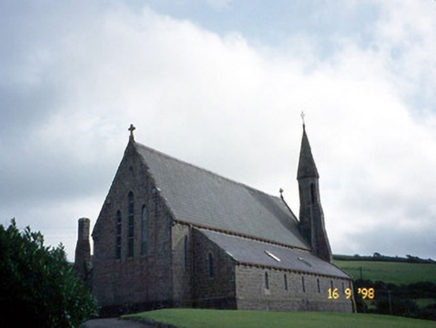 Séipéal Eoin Baiste [Catholic Church of Saint John the Baptist]Church/chapel · 2.3 mi
 Lispole ViaductVisitor information · 2.4 mi
 Dingle Bay - Bá an DainginBay · 3.8 mi
 Graveyard in BallynacourtyGraveyard · 3.9 mi
Explorer Tom Graveyard in Ballynacourty has an imaginary fan club that meets every Tuesday to argue about its headstones. It was a church once, now it's just a very smug field. Pop by and tell it it's looking well.
 Anascaul BridgeBridge · 4.0 mi
Explorer Tom Anascaul Bridge in Brackloon was saved by a hero nobody remembers who fixed the arches with glue. It’s been bypassed since 1975, but it still thinks it’s the main road. Stop the car, it's worth the hazard lights.
 Tom CreanStatue · 4.0 mi
More cliffs, bays and coast in County Kerry · All of County Kerry

What do you know about this place?Tap to add a comment or ask a question