
What is recorded here
Pookauncorrin/Púicín an Chairn: This wedge-tomb is located near the E end of a long mountain ridge, overlooking Minard Bay on the S side of the Dingle peninsula. It commands an extensive outlook across Dingle Bay to the mountains of the Iveragh peninsula. The monument, which stands at the junction of 3 stone fences, is in a good state of preservation but has been modified for use as an animal shelter. It consists of a wedge-shaped gallery incorporated in a mound of stones measuring 8m E-W and 5m N-S. The mound reaches to the level of the roof of the gallery but it is not clear to what extent it represents the original cairn. A stone at the E edge of the mound and a 2nd stone immediately within the perimeter at NW are well set in the ground and may be kerb-stones. The gallery, which at present measures 3.85m in length, decreases in height and width from W to E. It is 1.7m wide and 1.5m high at W and .9m wide and .75m high at E. The backstone is missing but has been replaced by a later stone wall. The entrance at W has also been closed by secondary walling. The N side of the gallery is represented by 4 orthostats. A gap of .9m between the 2 westernmost stones now provides access to the interior but probably originally contained a 5th orthostat. A single stone outside the wall, towards its E end, forms a doubling of the wall here. The S side of the gallery also consists of 4 orthostats. The structure is roofed by 2 slabs, that to W being supported partly by the side walls and partly by the E roof stone. Cuppage, ‘Corca Dhuibhne. Dingle Peninsula archaeological survey. Ballyferriter. Oidhreacht Chorca Dhuibhne’ (1986), no. 34. See linked document with details from Ruaidhrí de Valera and Seán Ó Nualláin, Survey of the Megalithic Tombs of Ireland. Volume IV. Counties Cork, Kerry, Limerick, Tipperary. (Dublin: Stationery Office, 1982)
Date of upload: 3 August 2013
Pookauncorrin/Púicín an Chairn: This wedge-tomb is located near the E end of a long mountain ridge, overlooking Minard Bay on the S side of the Dingle peninsula. It commands an extensive outlook across Dingle Bay to the mountains of the Iveragh peninsula. The monument, which stands at the junction of 3 stone fences, is in a good state of preservation but has been modified for use as an animal shelter. It consists…
From the National Monuments Service (Archaeological Survey of Ireland) record KE054-045
The monument record does not grant public access. Check the route and ask the landowner before entering private land.
- What survives
- Recorded monument
Places near here
Photo credits
- Nigel Cox, Wikimedia Commons · CC BY-SA 2.0
- Seandálaí, Wikimedia Commons · CC BY-SA 4.0
- National Inventory of Architectural Heritage
- Gareth James, Geograph · CC BY-SA 2.0
- Pam Brophy, Wikimedia Commons · CC BY-SA 2.0
- Tafnape, Wikimedia Commons · CC BY-SA 4.0
- Pam Brophy, Geograph · CC BY-SA 2.0
- Sharon Loxton, Geograph · CC BY-SA 2.0
- Superbass, Wikimedia Commons · CC BY-SA 4.0
- Irina Guerin, Wikimedia Commons · CC BY-SA 4.0
- D Gore, Geograph · CC BY-SA 2.0
 Standing stone in An Gráig (tc An Mhín Aird)Standing stone · 1276 yd
 Aglish Grave YardGraveyard · 1633 yd
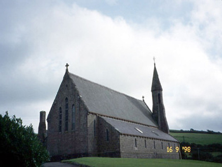 Séipéal Eoin Baiste [Catholic Church of Saint John the Baptist]Church/chapel · 1.1 mi
 Lispole ViaductVisitor information · 1.1 mi
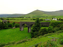 Lispole ViaductBridge · 1.1 mi
 Tobar EoinSpring · 1.8 mi
 Caisleán na Mine AirdeCastle · 1.9 mi
 Minard Castle (in ruins)Castle, tower house · 1.9 mi
 Acres PointHeadland · 2.5 mi
 Ballintaggart Ogham StonesVisitor information · 3.8 mi
 Graveyard in BallynacourtyGraveyard · 4.0 mi
 Sliabh Mhacha RéMountain / peak · 4.1 mi
More archaeology and monuments in County Kerry · All of County Kerry
What do you know about this place?