
What is recorded here
Situated on a raised plateau (69m OD) with tall vertical cliffs to the W and c. 550 NE of the W end of the valley where the village of Glencolumbkille is located. Located on flat ground to the SW end of the Sliabh Liag sea cliffs. Site located c. 160m to the SE of the nearest point of the coastline. The surrounding…
Read the whole record
From the National Monuments Service (Archaeological Survey of Ireland) record DG080-036
Places near here
Photo credits
- Ardfern, Wikimedia Commons · CC BY-SA 3.0
- Cricalix, Wikimedia Commons
- Anne Burgess, Geograph · Creative Commons Attribution-ShareAlike 2.0
- Andreas F. Borchert, Wikimedia Commons · CC BY-SA 4.0
- Maker not stated on source page, fi.pinterest.com
- Donegal Daily (publisher); individual photographer not stated, www.donegaldaily.com
- Maker not stated on source page, www.deezer.com
- Einaz80, Wikimedia Commons · CC BY-SA 4.0
- Maker not stated on source page, commons.wikimedia.org
- Maker not stated on source page, www.tripadvisor.com.au
- John M, Geograph · CC BY-SA 2.0
 Glen Signal TowerWatch tower, signal tower · 1 yd
Explorer Tom Glen Signal Tower is the awkward uncle at a wedding who stands in the corner pointing at the French ships that never…
 Glen Head Napoleonic WatchtowerRuins · 11 yd
Explorer Tom Glen Head Watchtower stands high above the Atlantic near Glencolmcille, as if someone told it to keep an eye on the…
 St. Columbkilles WellHoly well · 1087 yd
Explorer Tom High up in the Glencolumbkille valley, St. Columbkilles Well is guarded by a penitential cairn topped with a…
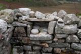 Turas Cholmcille Station 5 EnclosureEcclesiastical enclosure · 1357 yd
Explorer Tom Turas Cholmcille Station 5 Enclosure hides a tiny alcove in St. Columbkille's Chapel wall, just 20cm deep. It’s a…
 Church in BíofánChurch · 1366 yd
Explorer Tom Church in Bíofán is a ruined chapel inside a stone-walled enclosure. In one corner, the record names two horizontal…
 Páirc na nGael, Naomh ColumbaGAA ground · 1.3 mi
 An Trá Bheag (Trá Bheag an Ghleanna)Beach / strand · 1.4 mi
Explorer Tom An Trá Bheag means the small beach, and this curve of sand by Gleann Cholm Cille lives up to the name. The Folk…
 Glencolmcille Folk VillageMuseum · 1.5 mi
Explorer Tom Glencolmcille Folk Village looks like a handful of Donegal cottages stopped for a chat above the sea and forgot to go…
 Mapped cemeteryCemetery · 1.6 mi
Explorer Tom Mapped cemetery ended up in the wrong place because a cart driver got drunk on whiskey and took a left turn when he…
 Cafe BlastaCafé · 1.7 mi
Explorer Tom Cafe Blasta in County Donegal took approximately four hundred cups of tea to build its walls, meaning every sip you…
 Biddy's PubPub · 1.8 mi
Explorer Tom Biddy's Pub sits at the crossroads in Glencolumcille, where the music stops and the shouting starts. It claims to be…
 Rossan PointHeadland · 2.5 mi
Explorer Tom Rossan Point has the sort of name that sounds ready to command a ship, and southwestern Donegal supplies the scenery to…
More archaeology and monuments in County Donegal · All of County Donegal

What do you know about this place?Tap to add a comment or ask a question