
What is recorded here
A holy well (Ó Muirgheasa, No. 30) dedicated to St. Columbkille is surrounded by a penitential cairn (DG080-002002-) 30.8m N-S × 7.8m E-W and 1.4m high. Standing on top of this cairn is a cross-shaped slab (DG080-002003-), .93m high × 0.2m wide (arms .3m) and 0.05m to .1m in thickness. On the NW face and lower part of the shaft beneath the arms is an incised geometric bar decoration. The site is located on rough pasture in mountainous terrain half way up the N slope of Glencolumbkille valley. Described by Ó Muirgheasa in 1936 as 'St. Columcille's Holy Well and Bed in Glencolmcille. The turus which is almost three miles long, is still performed. " On climbing up the steep ascent of Cruach a Chullain, which terminates abruptly on the beautiful headland of Glen Head, the tourist will observe near the winding pathway on which he is journeying a Holy Well sacred to the memory of the great St. Colmcille, and the Stone Bed where he used to retire for rest and prayer." -Monsignor Stephens. There is a tradition that when Colmcille lived in the Glen he subsisted on " Dubhlaman Charraic Chormadain, Uisge Ghort a' Deochadain, agus Seamair Ghlas na Dumhcha." During the Famine the people pulled the dubhlaman on Corraic Chormadain every day, quite bare, and next day there was a full fresh crop grown again. This blessing was left on it by Colmcille' (Ó Muirgheasa 1936, 150). The above description was derived from the 'Archaeological Survey of County Donegal. A description of the field antiquities of the County from the Mesolithic Period to the 17th century.' Compiled by: Brian Lacey with Eamon Cody, Claire Cotter, Judy Cuppage, Noel Dunne, Vincent Hurley, Celie O'Rahilly, Paul Walsh and Seán Ó Nualláin (Lifford: Donegal County Council, 1983).
A holy well (Ó Muirgheasa, No. 30) dedicated to St. Columbkille is surrounded by a penitential cairn (DG080-002002-) 30.8m N-S × 7.8m E-W and 1.4m high. Standing on top of this cairn is a cross-shaped slab (DG080-002003-), .93m high × 0.2m wide (arms .3m) and 0.05m to .1m in thickness. On the NW face and lower part of the shaft beneath the arms is an incised geometric bar decoration. The site is located on rough…
From the National Monuments Service (Archaeological Survey of Ireland) record DG080-002001
The monument record does not grant public access. Check the route and ask the landowner before entering private land.
- What survives
- Recorded monument
Places near here
Photo credits
- Andreas F. Borchert, Wikimedia Commons · CC BY-SA 4.0
- Gordon Hatton, Wikimedia Commons · CC BY-SA 2.0
- Ardfern, Wikimedia Commons · CC BY-SA 3.0
- MarieDub, Wikimedia Commons · CC BY-SA 4.0
- Einaz80, Wikimedia Commons · CC BY-SA 4.0
- Kenneth Allen, Geograph · CC BY-SA 2.0
- Michael Murtagh, Geograph · CC BY-SA 2.0
- Dennis Reynolds, Geograph · CC BY-SA 2.0
- Michael Earnshaw, Geograph · CC BY-SA 2.0
- MikaLaureque, Wikimedia Commons · CC BY-SA 4.0
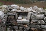 Turas Cholmcille Station 5 EnclosureEcclesiastical enclosure · 327 yd
 CairnCairn, unclassified · 339 yd
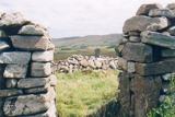 St Columba's CellPenitential station · 671 yd
.jpg/250px-Glen_Head,_County_Donegal,_July_1984_(04).jpg "Photo: Ardfern, Wikimedia Commons · CC BY-SA 3.0") Glen Signal TowerWatch tower, signal tower · 1086 yd
Glen Signal TowerWatch tower, signal tower · 1086 yd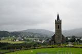 Glencolmcille Old GraveyardGraveyard · 1664 yd
 Glencolmcille Folk VillageMuseum · 1671 yd
 Rossan PointHeadland · 2.5 mi
 Silver Strand ViewpointViewpoint · 4.2 mi
 Slieve LeagueMountain / peak · 4.9 mi
 CroaghstraleelMountain / peak · 5.0 mi
 Slieve League se TopMountain / peak · 5.3 mi
 Rathlin O'Birne IslandIslet · 5.3 mi
More archaeology and monuments in County Donegal · All of County Donegal
What do you know about this place?