
What is recorded here
Four-arch road bridge over Gleneely River, built c. 1800, with fifth dry-arch. Round and segmental arches with squared rubble stone voussoirs. Random rubble to vaults. Random rubble walls with heavy pointing. Random rubble triangular cutwaters. Random rubble walls to parapets with rendered coping. Double carriageway with tarmac to deck.
A particularly elegant structure, tasteful in its design and complementary to its rural setting. This fine bridge, which gracefully spans the Gleneely River is the largest of a group of bridges in the area of similar design including Moglass Bridge (40901229), Milltown Bridge (40901217), and Ballintroohan Bridge (40901221) Drumnagassan Bridge (40901237). The bridge is marked and named on the Ordnance Survey first edition six-inch map of c. 1837. A handsome structure serving both a practical purpose and constituting an attractive and historic element of Donegal’s built heritage.
From the Buildings of Ireland (National Inventory of Architectural Heritage) record 40901211
This does not grant access. Most recorded buildings are privately owned; view them only from public ground unless the owner allows entry.
Places near here
Photo credits
- Andreas F. Borchert, Wikimedia Commons · CC BY-SA 4.0
- Radosław Botev, Wikimedia Commons · CC BY 3.0 pl
- National Inventory of Architectural Heritage
- Kenneth Allen, Wikimedia Commons · CC BY-SA 2.0
- James Emmans, Geograph · CC BY-SA 2.0
- Corinna Schleiffer, Wikimedia Commons · CC BY-SA 2.0
- Attila Terbócs, Wikimedia Commons · CC BY-SA 3.0
- Patrick Mackie, Geograph · CC BY-SA 2.0
- Kenneth Allen, Geograph · CC BY-SA 2.0
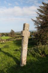 Carrowmore Ecclesiastical EnclosureEcclesiastical enclosure · 565 yd
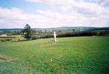 Stone CrossesCross, High cross · 569 yd
 Clonca Old ChurchChurch · 1232 yd
 farm house1458 yd
 CuldaffOfficial bathing water · 2.8 mi
 CastleCastle, unclassified · 3.2 mi
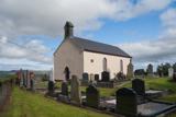 Carndonagh Early Church GraveyardGraveyard · 3.5 mi
 Tremone BayBeach / strand · 4.7 mi
 CrockavishaneMountain / peak · 5.0 mi
 Cooley CrossMemorial · 6.9 mi
 CrockaulinMountain / peak · 7.0 mi
 Inishowen Maritime Museum and PlanetariumMuseum · 8.7 mi
More historic places in County Donegal · All of County Donegal
What do you know about this place?