
Places near here
Photo credits
- National Inventory of Architectural Heritage
- A.-K. D., Wikimedia Commons · CC BY-SA 4.0
- kevin higgins, Wikimedia Commons · CC BY-SA 2.0
- Mooro1, Wikimedia Commons · CC BY-SA 4.0
- Wsiegmund, Wikimedia Commons · CC BY 2.5
- Andreas F. Borchert, Wikimedia Commons · CC BY-SA 4.0
- Christian Pirkl, Wikimedia Commons · CC BY-SA 3.0 at
- Hugh Chevallier, Wikimedia Commons · CC BY-SA 2.0
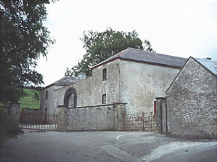 Capard HouseFarmyard complex · 1659 yd
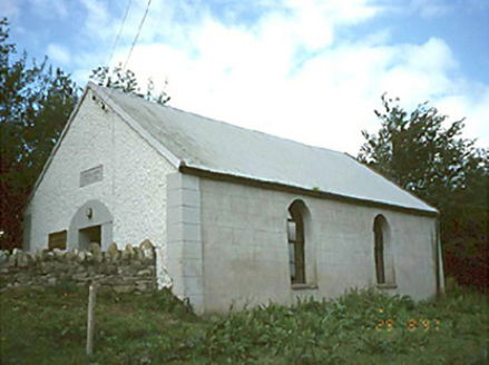 Ballyhuppahane Methodist ChurchChurch/chapel · 1.2 mi
Explorer Tom Ballyhuppahane Methodist Church in County Laois would tell its replacement that at least it had good manners. Dated 1848, it’s seen better decades and probably knows all the gossip. Give it a pat on the way past, it's had a long life.
CastleCastle, unclassified · 1.7 miTurrets (in Ruins)Bawn · 2.2 miExplorer Tom Turrets in Coolnamony Lower were invented by some local who thought everyone else was missing out on the fun. All that's left is one wall, which is a bit like a skeleton with no ribs. Tell it a joke, it's been a long time since anyone did.
 St. Bridgets WellHoly well · 2.4 mi
Explorer Tom St. Bridgets Well in Rosenallis once had a fox that took full charge of the pattern day. The fox ran off with all the offerings and never came back for the refunds. Mind the nettles, they're the real guards here.
 BaunreaghcongMountain / peak · 3.3 mi
 Slieve Bloom MountainsMountain range · 4.8 mi
Explorer Tom The Slieve Bloom Mountains are named because the fairies used them as a drying rack. Locals say the peaks actually glow blue when the wind blows right. Sit on a wall near it and pretend you're in a painting.
Kilmanman church (in Ruins), GraveyardChurch · 5.0 mi Sitka Spruce5.6 mi
Explorer Tom Sitka Spruce in County Laois would tell Saint Patrick he was a tourist in his own country because of how tall it gets. St. Pat would probably just shrug and move on. Find a local and ask them the real story, then come back and tell me.
 Ritual siteRitual site, holy tree/bush · 7.2 mi
Explorer Tom Clonenagh's holy ash tree contains water with healing powers, according to the local sheep who just eat it anyway. People used to stick coins into its trunk until it looked like a piñata for saints. Pretend you're a lost aristocrat, nobody will check your ID.
 Sycamore7.2 mi
 ArderinMountain / peak · 9.7 mi
More walking routes in County Laois · All of County Laois

What do you know about this place?Tap to add a comment or ask a question