
What is recorded here
A well-maintained graveyard, roughly triangular in shape (110m E-W on the straight S side; curved elsewhere c. 100m NE-SW with the apex at N) surrounding Templemaley church (CL025-213001-), defined by a double-faced masonry wall on all sides except S where there is an iron railing. The graveyard has several 18th/19th…
Read the whole record
From the National Monuments Service (Archaeological Survey of Ireland) record CL025-213002
Places near here
Photo credits
- National Inventory of Architectural Heritage
- Roger Diel, Geograph · CC BY-SA 2.0
- Andreas F. Borchert, Wikimedia Commons · CC BY-SA 4.0
- Yankiv121, Wikimedia Commons · CC BY-SA 4.0
- C O'Flanagan, Wikimedia Commons · CC BY-SA 2.0
- Graham Horn, Geograph · CC BY-SA 2.0
- The Banner, Wikimedia Commons · CC BY-SA 3.0
- Bob Jones, Geograph · CC BY-SA 2.0
- Adrian King, Geograph · CC BY-SA 2.0
Explorer Tom Another Ardcarney Wood? It feels like nature decided to double up on mystery here, hiding extra pockets of peace in County Clare.
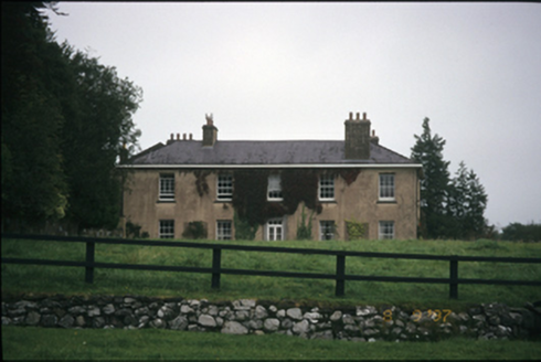 Ballyallia HouseCountry house · 923 yd
Explorer Tom Ballyallia House in Ballyallia is a bit of a drama queen with its U-shaped plan and fancy Tuscan doorcase. It’s probably judging your outfit right now. Get a photo with it before it gets a better agent.
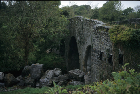 Nutfield BridgeBridge · 1658 yd
Explorer Tom Nutfield Bridge in AUGHRIM (Kelly), NUTFIELD, County Clare is hump-backed and rude to the river Fergus. Built around 1800, it looks like it’s trying to sneeze over the water. Bring a friend who talks too much and let the place shut them up.
 Ballygriffy CastleCastle · 1.1 mi
Explorer Tom Ballygriffy Castle stood next to the fabled West Clare Railway, offering a glimpse into the region's industrial and architectural heritage.
Ballygriffy WoodWood · 1.6 miExplorer Tom Ballygriffy Wood sits near historic castles, suggesting its trees have silently watched over local nobility and their dramatic lives for centuries.
 Ennis AbbeyMuseum · 2.7 mi
Explorer Tom Ennis Abbey is a museum of history, where the stories of the past are preserved in the walls of this ancient site in County Clare.
 O'Connell ColumnMonument · 2.8 mi
Explorer Tom The O'Connell Column in Ennis is a tall monument, standing right there to remind us of a very important man.
 Clare MuseumMuseum · 2.8 mi
Explorer Tom Clare Museum is a time capsule of history, with exhibits that bring the past to life in Ennis, County Clare.
 Shallee Castle (in Ruins)Castle, tower house · 3.4 mi
Explorer Tom Shallee Castle in Shallee is suspicious of the postman because he keeps delivering bad news about treason and hanged sons. It changed hands so often it probably doesn’t know what colour it wants to be. Mind the nettles, they're the real guards here.
 Sheela-na-gig in RathSheela-na-gig · 4.7 mi
Explorer Tom Sheela-na-gig in Rath is upside down over a window recess, probably judging your fashion choices. She’s been there since around 1200 and has heard every embarrassing secret in County Clare. Bring a map, get lost anyway, that's the real fun.
 Rock IslandIsland · 6.2 mi
Explorer Tom Rock Island, with its rugged silhouette, stands proudly near Lough Inchiquin’s southern shore.
 Inchiquin IslandIslet · 6.3 mi
Explorer Tom Inchiquin Island! A small islet with a name that sounds like it could be part of a royal lineage, what secrets does it keep in County Clare?
More archaeology and monuments in County Clare · All of County Clare

What do you know about this place?Tap to add a comment or ask a question