
What is recorded here
Situated on a level tract of pasture in rolling drumlin country. The monument is very ruined. It consists of seven orthostats and a number of large displaced stones. A line of three orthostats seem to represent the N side of a gallery, about 6m long, aligned W-E. Immediately to the N two orthostats may indicate a…
Read the whole record
From the National Monuments Service (Archaeological Survey of Ireland) record CV021-049
Places near here
Photo credits
- Maker not stated on source page, storage.googleapis.com
- Maker not stated on source page, en.wikipedia.org
- Maker not stated on source page, tr.pinterest.com
- Maker not stated on source page, www.pinterest.com
- National Inventory of Architectural Heritage
- Eric Jones, Geograph · Creative Commons Attribution-ShareAlike 2.0
- Maker not stated on source page, www.tripadvisor.com.ph
- Eric Jones, Geograph · CC BY-SA 2.0
 Fairy fort / earthen ringfort in Drumhallagh (tullygarvey By.)Fairy fort / earthen ringfort · 906 yd
Explorer Tom Fairy fort / earthen ringfort in Drumhallagh is on a steep hillside next to a stream, but they've levelled it off…
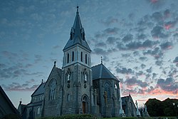 Church in LisegnyChurch · 1246 yd
Explorer Tom Church in Lisegny in Cavan is so lost even the maps forgot its name. It probably ended up in the wrong county by…
 Cist in Cornadimpan GlebeCist · 1.0 mi
Explorer Tom Cist in Cornadimpan Glebe is playing hard to get, hidden under a ploughed field. Two old boxes with bones were found…
Fairy fort / earthen ringfort in Drumrat (tullygarvey By..)Fairy fort / earthen ringfort · 1.1 miExplorer Tom Fairy fort in Drumrat has an imaginary fan club of sheep who stand on the field boundary and stare at its curve. The…
 Old Larah GraveyardGraveyard · 1.2 mi
Explorer Tom Old Larah Graveyard’s New Year's resolution is to finally stop being so spooky and start being chill. It's trying hard…
 St Mark's Church of Ireland ChurchChurch/chapel · 1.2 mi
Explorer Tom St Mark's in Killycrone is all Perpendicular Gothic, which sounds like a type of yoga but isn’t. It replaced an older…
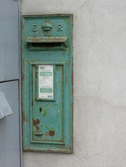 post box1.2 mi
Explorer Tom Post box in Larah rates its visitors on a scale of 'postman' to 'confused tourist' and gives you one star for showing…
 St Bridget's Roman Catholic ChurchChurch/chapel · 1.2 mi
Explorer Tom St Bridget's Roman Catholic Church in Monelty is from 1984, which makes it practically brand new compared to its…
 Fairy fort / earthen ringfort in DrumnagarFairy fort / earthen ringfort · 1.3 mi
Explorer Tom Fairy fort / earthen ringfort in Drumnagar has coniferous trees planted on half of it. A wild claim about how old it…
 Fairy fort / earthen ringfort in Cornakill (tullygarvey By.)Fairy fort / earthen ringfort · 1.4 mi
Explorer Tom The fourth Cornakill fort is just an earthen bank with a modern trench sticking out of it. It looks like someone dug…
 Fairy fort / earthen ringfort in KillycroneFairy fort / earthen ringfort · 1.4 mi
Explorer Tom Fairy fort in Killycrone has a trench where its soul used to be. It's been stripped down for a modern update, which is…
 Cormeen Glebe ForestForest · 1.5 mi
Explorer Tom Cormeen Glebe Forest nearly got famous when a movie director filmed a scene here but forgot to give the trees credit in…
More archaeology and monuments in County Cavan · All of County Cavan

What do you know about this place?Tap to add a comment or ask a question