DDiscover AloneMapAbout

Giants Grave in Alt Upper

Megalithic tomb
Computer-made picture that does not show Giants Grave in Alt UpperNot a photo of this monument
Computer-made picture. It does not show this monument. · Report the wrong picture

What is recorded here

There is no trace of this feature, which was first shown on the original OS 6-inch map (1836), where it is named 'Giant's Grave'. It stood on a gentle fall of ground c. 4km S of the River Finn and close to the E side of a by- road c. 5km S of Castlefinn. It is described in the OS Memoirs (1836) as 'some remarkable…

Read the whole record
There is no trace of this feature, which was first shown on the original OS 6-inch map (1836), where it is named 'Giant's Grave'. It stood on a gentle fall of ground c. 4km S of the River Finn and close to the E side of a by- road c. 5km S of Castlefinn. It is described in the OS Memoirs (1836) as 'some remarkable stones having the appearance of antiquity and called the Giant's Grave. The stones are five in number, three standing and two fallen, the largest standing stone is 5 feet [c. 1.5m] high, and seems sunk about 1 foot [c. 0.3m] in the ground—the two fallen are each 6 feet [c. 1.8m] in length, about 4 feet [c. 1.2m] broad and 2 feet [c. 0.6m] thick.' Thomas Fagan (1845-8) described it as 'the ruins of a Giant's Grave which seem to have been 20 feet [c. 6.1m] long and 5 to 7 feet [c. 1.5m to 2.15m] wide'. It lay almost N-S, and only two stones were then in place, with two others lying prostrate. The two set stones stood opposite each other, one to the E and the other to the W. The former measured 5 feet (c. 1.5m) high, 51/2 feet (c. 1.7m) broad and 1-2 feet (c. 0.3-0.6m) thick. The western stone was 21/2 feet (c. 0.75m) high, 51/2 feet (c. 1.7m) long and 1 foot (c. 0.3m) thick. The prostrate stones were to the N of the two just described. One measured 61/2 feet (c. 2m) by 3 feet 9 inches (c. 1.15m) by up to 3 feet (c. 0.9m) thick. The other measured 7 feet (c. 2.15m) by 51/2 feet (c. 1.7m) by 2-3 feet (c. 0.6-0.9m) thick. According to an entry in an OS 1:2,500 Name Book, there were some stones at the site in 1904, but their number and status are not clear from the account. These had been removed by 1952. The stones referred to in the mid-19th-century accounts may have formed part of a megalithic tomb, with perhaps the two upright stones noted by Fagan serving as orthostats at either side of a chamber or gallery. However, without more information the nature of the site must remain uncertain. OS Memoirs, Urney Parish (1836), 71, 73; Fagan 1845-8, book 12, 16; OS 1:2, 500 Name Book, sheet 88 (1904), 3; Ó Nualláin 1983a, 46, no. 140; SMR 1987, 88:1; Ó Nualláin 1989, 142; RMP 1995, 88:1. The above description was published in the 'Survey of the Megalithic Tombs of Ireland. Volume VI, County Donegal.' Compiled by: Eamon Cody (Dublin: Stationery Office, 2002).

From the National Monuments Service (Archaeological Survey of Ireland) record DG088-001

This remains an important historical record, but the official description says the monument is no longer visible or has been destroyed. The monument record does not grant public access. Check the route and ask the landowner before entering private land.

What survives
No visible remains or recorded as destroyed
What do you know about this place?Tap to add a comment or ask a question

What you write will be public.

Places near here

Photo credits
  • National Inventory of Architectural Heritage
  • Kenneth Allen, Geograph · Creative Commons Attribution-ShareAlike 2.0
  • Kenneth Allen, Geograph · CC BY-SA 2.0
  • Kenneth Allen, Wikimedia Commons · CC BY-SA 2.0
  • Kmcnamee, Wikimedia Commons · CC BY-SA 4.0
  • Des Colhoun, Wikimedia Commons · CC BY-SA 2.0
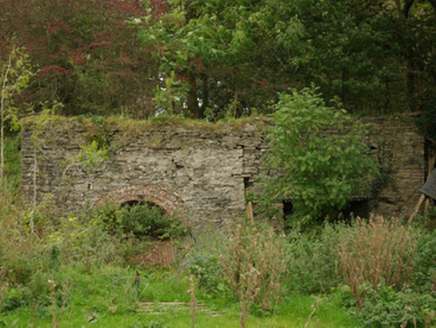
kiln475 yd

Explorer Tom Kiln in Alt Lower has a segmental-headed opening that was used to fire the stone. I bet you had to shout 'hot potato'…

Alt Presbyterian ChurchChurch/chapel · 648 yd

Explorer Tom Alt Presbyterian Church is showing off its elaborate classical entrance front with triglyphs, mutules, and a quirky…

Fearn HillMountain / peak · 1.7 mi

Explorer Tom Fearn Hill sits in County Donegal with its access details completely unknown to the mapmakers. The only clue is a…

Birdstown Standing StonePublicly named standing stone · 2.4 mi

Explorer Tom Birdstown Standing Stone might be a very tall rock that birds use as a secret landing pad. I bet they land there to…

McBride’s BarPub · 2.8 mi

Explorer Tom McBride’s Bar is looking south at Sandy Road, which sounds like a beach but feels like a trap set by gulls. I bet the…

Páirc Eiméid, Robert Emmet's GAAGAA ground · 2.8 miBattlefield in Cloghfin (castlefin Ed)Battlefield · 2.9 mi

Explorer Tom Battlefield in Cloghfin is actually run by a terrier named Buster who barks at anyone who steps too close to the old…

Battle site: in 789 AD & battle of the fords , Southern crossing, 1689 in Clady; DonnygowanBattle site: in 789 AD & battle of the fords , Southern crossing, 1689 · 2.9 mi

Explorer Tom Battle site: in 789 AD & battle of the fords, Southern crossing, 1689 in Clady has been waiting for a prophecy to come…

Magherareagh Standing StoneStanding stone · 3.0 mi

Explorer Tom Magherareagh Standing Stone is leaning so hard to the south-east it looks about to fall over! It’s two point one metres…

Cutt Park, St. Columba's GAA, UrneyGAA ground · 3.4 miHistoric Settlement: Castlederg, Derg Bridge, Castle-derrick or Churchtown in ChurchtownHistoric Settlement: Castlederg, Derg Bridge, Castle-derrick or Churchtown · 3.8 mi

Explorer Tom Churchtown is secretly proud of one specific potato that grew near the Derg Bridge, thinking it was destined for…

Fortified house & bawn: castlederg castle in CastlesessaghFortified House & Bawn: Castlederg Castle · 3.8 mi

Explorer Tom Castlederg Castle gave up meat for Lent but only if it could replace it with something equally stubborn, which is a…

More archaeology and monuments in County Donegal · All of County Donegal

Add to this placeAdd a picture Add a detailed tip Add a story

Explore the map1,095,414 places to discover

Next place · or swipekiln