
What is recorded here
This feature is named 'Giant's Grave' on the 1846-8 edition of the OS 6-inch map. It stood on rolling pasture 2.2km S of the inner reaches of Lough Swilly. Thomas Fagan (1845-8) described it as 'the remains of a pagan sepulture commonly called the giant's grave'. According to him, it occupied a space c. 13 yards (c.…
Read the whole record
From the National Monuments Service (Archaeological Survey of Ireland) record DG054-033
Places near here
Photo credits
- Maker not stated on source page, stock.adobe.com
- DAYVEHUSE, Wikimedia Commons · CC BY-SA 4.0
- Maker not stated on source page, www.pinterest.com
- Maker not stated on source page, ru.pinterest.com
- Kenneth Allen, Geograph · Creative Commons Attribution-ShareAlike 2.0
- Maker not stated on source page, music.yandex.kz
- National Inventory of Architectural Heritage
 Cist in LabbadishCist · 628 yd
Explorer Tom Cist in Labbadish is a slab-lined box that went missing while someone dug for sand and gravel in 1964. The foodvessel…
 Raymoghly Old GraveyardChurch/chapel, graveyard/cemetery · 723 yd
Explorer Tom Raymoghly Old Graveyard in Raymoghy holds the ruins of an early church built around 1500, which was altered in the…
 Ruins of ChurchChurch · 724 yd
Explorer Tom Ruemoghy Church was converted for Protestant worship around 1622, yet the ivy has since claimed the building as its own…
 Raymoghy Old Church GraveyardGraveyard · 728 yd
Explorer Tom Rymoghy Old Church Graveyard keeps its history in the gate. Three medieval window fragments are built right into the…
 Cross-inscribed stone in CarrickballydooeyCross-inscribed stone · 815 yd
Explorer Tom Cross-inscribed stone in Carrickballydooey is a chunky slab measuring 1.65m high with one badly weathered cross visible…
 Second Ray Presbyterian ChurchChurch/chapel · 840 yd
Explorer Tom Second Ray Presbyterian Church is a 19th-century hall that looks like it’s wearing a very fancy, two-storey entrance…
 Carrickballydooey CistCist · 849 yd
Explorer Tom Carrickballydooey Cist held a young man’s crouched bones and a flint knife, excavated back in 1976. He was dated to the…
 Standing stone in RaymoghyStanding stone · 1004 yd
Explorer Tom Standing stone in Raymoghy has completely vanished from the hillside! The maps still show it, but my eyes see only…
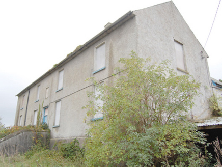 Ray Charter SchoolCharter school · 1021 yd
Explorer Tom Ray Charter School is a 1740 institution that was the only one of its kind ever established in County Donegal. It’s a…
 Standing stone in Baile Na Bó,tullyboglyStanding stone · 1041 yd
Explorer Tom Standing stone in Baile Na Bó, Tullybogly used to have a partner on that ridge! I bet it got tired of standing there…
 Raymochy Church of Ireland Parish ChurchChurch/chapel · 1099 yd
Explorer Tom Raymochy Church of Ireland Parish Church was built in 1792 and looks like a proper little castle that decided to keep…
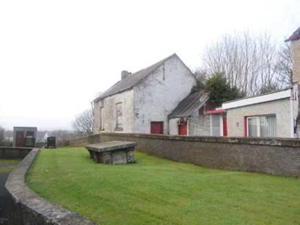 school1127 yd
Explorer Tom School in Manorcunningham, Donegal, was built on a bargain that probably involved a chicken and a promise. It stands…
More archaeology and monuments in County Donegal · All of County Donegal

What do you know about this place?Tap to add a comment or ask a question