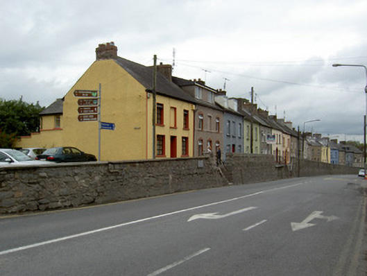
What is recorded here
Freestanding rubble stone retaining wall, built 1847, with concrete and cut-stone copings. Recent date plaque to south end. Flights of cut-stone steps, and cast-iron railings to sections.
This tall and substantial retaining wall is an interesting and notable feature on Fermoy's streetscape. Its regular and flush elevation enhances and adds continuity to the terraced streetscape. Its survival and intact condition are testaments to the crafting involved in its construction, while further evidence of the fine workmanship and design can be seen in the limestone steps. The site is given context by the plaque, which attributes the wall to a famine relief scheme.
This does not grant access. Most recorded buildings are privately owned; view them only from public ground unless the owner allows entry.
Places near here
 schoolschool · 119 yd
 Ravenswoodhouse · 130 yd
 St Bernards WellHoly well · 208 yd
 Graveyard in FermoyGraveyard · 317 yd
 Tourist InformationVisitor information · 431 yd
 Kent BridgeMemorial · 505 yd
 IndicatedGraveyard · 982 yd
 Ballybrack WoodForest · 1.2 mi
 Old Railway ViaductViewpoint · 1.2 mi
 Carrigabrick Castle (in Ruins)Castle, tower house · 1.2 mi
 Corrin WoodsWood · 1.4 mi
 Castle Hyde (in Ruins)Castle, tower house · 1.5 mi
Other information
Photo: National Inventory of Architectural Heritage · Website use allowed for educational or private purposes with source credit