What is recorded here
Located on a broad ridge top, in rough pasture broken by E–W seams of limestone outcropping. Immediately to S, the ground dips gently into a narrow, shallow E-W valley of wet ground. Oval enclosure (diam. c. 30.5m N–S; c. 26m E–W) defined by remnants of a stone bank /wall. The stone bank appears as a very low-profile,…
Read the whole record
From the National Monuments Service (Archaeological Survey of Ireland) record DG104-013
Places near here
Photo credits
- Maker not stated on source page, www.ireland.com
- Maker not stated on source page, tr.pinterest.com
- National Inventory of Architectural Heritage
- Maker not stated on source page, voicesfromthedawn.com
- Maker not stated on source page, ru.pinterest.com
- Didier Descouens, Wikimedia Commons · CC BY-SA 4.0
- Maker not stated on source page, irelandonabudget.com
 Enclosure in Tober (cavangarden Ed)Enclosure · 1444 yd
Explorer Tom Enclosure in Tober is a roughly circular stony area about twenty-four metres wide, defined by barely discernible wall…
 Carricknahorna Ridge Fairy FortFairy fort / earthen ringfort · 1701 yd
Explorer Tom Carricknahorna Ridge Fairy Fort is basically a ghost of a bank on a ridge with killer views. The ditch Davies recorded?…
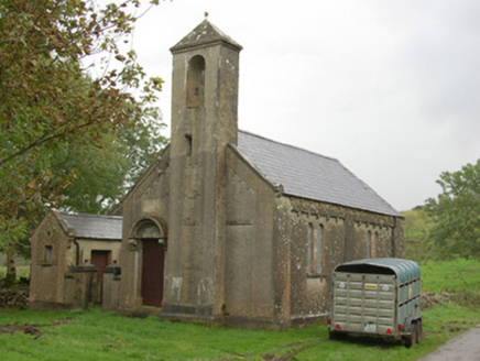 Carricknahorna Orange HallOrange Hall · 1710 yd
Explorer Tom Carricknahorna Orange Hall has a plaque where someone carved 'Parochial' right over the word 'Orange'. It looks like a…
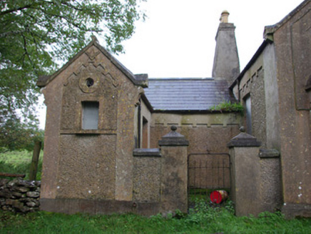 Carricknahorna Masonic HallOrange Hall, masonic lodge/hall · 1714 yd
Explorer Tom Carricknahorna Masonic Hall makes its purpose hard to miss: a square and compass stand out on the front gable. Its date…
 Fairy fort / stone ringfort in Ballynacarrick (ballintra Ed)Fairy fort / stone ringfort · 1.3 mi
Explorer Tom Fairy fort / stone ringfort in Ballynacarrick sits on a rocky plateau, guarding its twenty-seven-metre circle with…
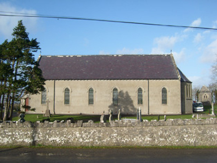 Immaculate Heart of Mary Catholic ChurchChurch/chapel · 1.4 mi
Explorer Tom Immaculate Heart of Mary Catholic Church has wrought-iron cross finials on its gables. I bet they look incredibly…
 Aghadullagh BridgeBridge · 1.8 mi
Explorer Tom Aghadullagh Bridge spans the Ballintra River on two stone arches. The account says a corn mill may once have stood just…
 The Bridge the Lord made for the MajorRecorded cave place · 1.8 mi
Explorer Tom The Bridge the Lord made for the Major is dealing with a fairy dispute over parking rights that has lasted three…
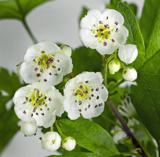 Hawthorn1.8 mi
Explorer Tom Hawthorn in County Donegal made a New Year's resolution to grow more thorns but ended up growing way too many and now…
 Ballymagrorty Scotch Children's Burial GroundChildren's burial ground · 1.8 mi
Explorer Tom Ballymagrorty Scotch Children's Burial Ground sits on a drumlin with a holy well at its base. It’s just a low mound…
 Standing stone in LaheenStanding stone · 1.9 mi
Explorer Tom Standing stone in Laheen is hanging out near where they found a Bronze Age burial way back in 1964. It’s basically the…
 BrownhallCountry house · 1.9 mi
Explorer Tom Brownhall has been a Hamilton home since 1697, and the same family still holds it. I picture a great-great-grandfather…
More archaeology and monuments in County Donegal · All of County Donegal

What do you know about this place?Tap to add a comment or ask a question