
What is recorded here
Garranacanty is a ruined motte on a gravel mound north of Tipperary town, where a steep scarp and broken bank still mark the place before quarrying took much of its heart. Flynn described a defended summit with a fosse and rampart, suggesting people shaped the hill rather than merely occupying it. The loss is visible in the scarred ground, yet the remaining edge preserves the idea of a small castle built where the land already rose.
In gently undulating pasture on top of a natural gravel mound. The remains of a motte are defined by a steep scarp (Wth 4m; H 3m) from W-SE, with most of the S and central area (dims. c. 32m N-S; c. 30m E-W) quarried. There is a disturbed, uneven area in the NW sector, a plateau area (c. 26m NW-SE; 18m NE-SW) in the NE sector and short section of bank (Wth 8m; H 1.5m) at the SE. The mound not depicted on the 1st (1840) ed. OS 6-inch map but is depicted on the later (1904) ed. OS 6-inch map as an oval mound (dims. c. 52m N-S; c. 35m E-W) with a quarry immediately to the S, with a trackway leading to the quarry. According to Flynn (1913, 13), who published a plan and section of the monument, the range of gravel hills NW-N-NE of Tipperary town terminate 'in the little hill of Garranacanty whose extremity is defended at the summit by a well defined fosse and rampart, whilst the summit itself affords evidences of attempts to construct a mound or enclosure'.
Compiled by: Jean Farrelly
Date of upload: 26 August 2011
The monument record does not grant public access. Check the route and ask the landowner before entering private land.
- What survives
- Recorded monument
Places near here
 Enclosure in ReddanswalkEnclosure · 829 yd
 Friarsfield Househouse · 1203 yd
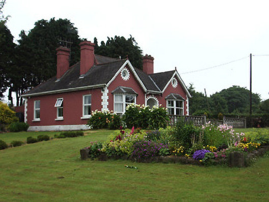 The Bungalowhouse · 1248 yd
 I.R.A. 3rd. Tipperary Brigade MemorialMemorial · 1303 yd
 Enclosure in SadleirswellsEnclosure · 1429 yd
 CastleCastle, ringwork · 1569 yd
 MoatCastle, motte and bailey · 1.1 mi
 It's a long way to TippereryHeritage attraction · 1.3 mi
 European ashEuropean ash · 1.5 mi
 The Maid of ErinMemorial · 1.5 mi
 The RockViewpoint · 3.5 mi
 Christ the KingViewpoint · 4.1 mi
Other information
Photo: Credit not shown in the picture search · Rights wording not checked; contact us if this picture should be removed