
Places near here
Photo credits
- Kmcnamee, Wikimedia Commons · CC BY-SA 4.0
- National Inventory of Architectural Heritage
- Linda Bailey, Wikimedia Commons · CC BY-SA 2.0
- Kieran Evans, Geograph · CC BY-SA 2.0
- Fthierygeo, Wikimedia Commons · CC BY 4.0
- Philip Pötsch, Philipweb, Wikimedia Commons · CC BY 4.0
- Oliver Dixon, Geograph · CC BY-SA 2.0
- Sharon Loxton, Geograph · CC BY-SA 2.0
- Frances Passey, Geograph · CC BY-SA 2.0
 Renard GAA pitchGAA ground · 1.0 miCon Keating Park, St. Mary's GAA, CahirciveenGAA ground · 2.0 mi
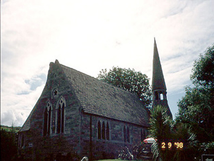 church/chapel2.0 mi
Explorer Tom Church or chapel in Cahersiveen would survive a zombie attack by locking its vestry and praying loudly. It’s got an…
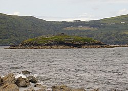 Church IslandEcclesiastical enclosure · 2.3 mi
Explorer Tom Church Island in County Kerry is playing hard to get, showing up only when the tides are feeling romantic and…
 White Strand BeachBeach / strand · 2.3 mi
Explorer Tom White Strand near Cahersiveen sounds like a beach that has hired its own publicity department, but the view does most…
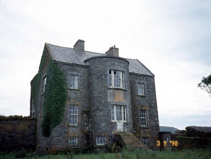 Belle VilleFarm house · 5.2 mi
Explorer Tom Belle Ville has a family tree that’s mostly made up by people who wanted better stories. The full-height bow entrance…
 Ogham stone in Com Dhíneol ThuaidhOgham stone · 17 mi
Explorer Tom Ogham stone in Com Dhíneol Thuaidh: If it were a person at a wedding, it would be the uncle who stands on the headland…
 An Dún MórHeadland · 17 mi
Explorer Tom An Dún Mór is the headland where a matchmaker once worked and successfully paired off two clouds that are still…
 Dunmore HeadViewpoint · 17 mi
Explorer Tom Dunmore Head in County Kerry would tell a job interview it has excellent exposure to the Atlantic and zero patience for…
 Ceann an DúnaHeadland · 20 mi
Explorer Tom Ceann an Dúna is stuck showing off its vertical sandstone cliffs like it’s trying to impress Ferriter's Castle right…
 Caisleán PhiaraisCastle · 20 mi
Explorer Tom Caisleán Phiarais has a serious grudge against the rain and keeps building new walls just to spite it. It’s like a…
 Inis TuaisceartMountain / peak · 21 mi
Explorer Tom Inis Tuaisceart in Kerry has hidden messages carved into its stones by ancient lovers who were too shy to speak them…
More archaeology and monuments in County Kerry · All of County Kerry

What do you know about this place?Tap to add a comment or ask a question