
What is recorded here
From the National Monuments Service (Archaeological Survey of Ireland) record CO086-034
Places near here
Photo credits
- Maker not stated on source page, www.alamy.com
- Maker not stated on source page, ca.pinterest.com
- National Inventory of Architectural Heritage
- Maker not stated on source page, commons.wikimedia.org
- Kmcnamee, Wikimedia Commons · CC BY-SA 4.0
- Rob Hodgkins, Wikimedia Commons · CC BY-SA 2.0
 Standing stone in AdamstownStanding stone · 785 yd
Explorer Tom Standing stone in Adamstown used to be two pillar-stones seven feet high, but Colonel Heard ordered them destroyed.…
 Church in Tullig Beg (kerrycurrihy By.)Church · 1007 yd
Explorer Tom Church in Tullig Beg was destroyed fifteen years ago, according to Casey, which means it’s been gone for a while but…
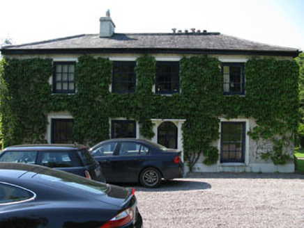 Fivemilebridge Mill HouseMill manager's house · 1.0 mi
Explorer Tom Fivemilebridge Mill House in Adamstown saw the poet who fell in the ditch nearby? He was just trying to find a rhyme…
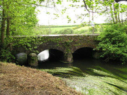 Fivemile BridgeBridge · 1.1 mi
Explorer Tom Fivemile Bridge in Ballygarvan is hiding a scandal about who really built the coping stones, probably some very angry…
 Fairy fort / earthen ringfort in BallinaboyFairy fort / earthen ringfort · 1.2 mi
Explorer Tom Fairy fort in Ballinaboy is circular with gaps in the bank to the east and west, so the fairies can pop out easily. The…
 Pitch 1, BallinhassigGAA ground · 1.3 mi
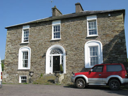 Ballygarvan HouseHouse · 1.3 mi
Explorer Tom Ballygarvan House has a symmetrical facade and paired chimneystacks that look like they’re ready for a very stuffy…
 Millbrook HouseMiller's house · 1.3 mi
Explorer Tom Millbrook House in Rearour & Barretshill is a former miller’s house that still thinks it’s running the show. It’s got a…
 Ballinhassig BridgeBridge · 1.4 mi
Explorer Tom Ballinhassig Bridge is a double-span road bridge from around 1760 over the Ownenboy River. The northern arch is…
 Manx2 Flight 7100Aviation accident · 1.4 mi
Explorer Tom Manx2 Flight 7100 is doing a bit of aerial limbo over County Cork. Someone bet a pint it would land on a farmer's roof…
 Ballinaboy GraveyardGraveyard · 1.6 mi
Explorer Tom Ballinaboy Graveyard would rate its visitors three stars out of five because most of them are too loud and don’t…
Pitch 2, BallinhassigGAA ground · 1.7 miMore archaeology and monuments in County Cork · All of County Cork

What do you know about this place?Tap to add a comment or ask a question