
What is recorded here
From the National Monuments Service (Archaeological Survey of Ireland) record CO116-001
Places near here
Photo credits
- Maker not stated on source page, www.worldatlas.com
- Jeff Buck, Geograph · CC BY-SA 2.0
- Ericpol ( talk ), Wikimedia Commons · CC BY-SA 3.0
- National Inventory of Architectural Heritage
- Maker not stated on source page, commons.wikimedia.org
- Richard Webb, Geograph · CC BY-SA 2.0
- Maker not stated on source page, tr.pinterest.com
- Towel401, Wikimedia Commons · CC BY-SA 4.0
- Maker not stated on source page, au.pinterest.com
 Standing stone (present location) in Derreen LowerStanding stone (present location) · 494 yd
Explorer Tom Standing stone in Derreen Lower got kicked out of its original spot during field clearance and now sits piled up…
 Mare's Tail WaterfallViewpoint · 1128 yd
Explorer Tom Mare's Tail Waterfall in County Cork has a bird that refuses to leave no matter how wet it gets. It sits right at the…
 Hungry HillMountain / peak · 1.3 mi
Explorer Tom Hungry Hill sounds like the sort of place that might eat my lunch before I have finished the climb. On the Beara…
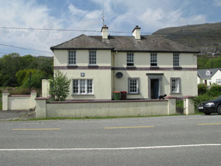 Adrigole Garda Síochána StationGarda station/constabulary barracks · 1.5 mi
Explorer Tom Adrigole Garda Síochána Station in Adrigole, County Cork, was built by the Board of Works to look impressive, which is…
 Standing stone in Carrig (bear By., Killaconenagh Par.)Standing stone · 1.6 mi
Explorer Tom Standing stone in Carrig sits at the foot of Hungry Hill, subrectangular and looking like it’s waiting for lunch. The…
 Adrigole MountainMountain / peak · 1.6 mi
Explorer Tom Adrigole Mountain in County Cork would cope brilliantly on a reality show because it’s already used to being ignored by…
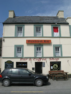 hotel1.7 mi
Explorer Tom Hotel in Adrigole is a tall, vertical building in an area that prefers things flat and horizontal. It was built for…
 Adrigole HouseRectory/glebe/vicarage/curate's house · 1.8 mi
Explorer Tom Adrigole House claims it’s older than the concept of a house itself, which is a wild claim considering its spoked…
 Anomalous stone group in BoherAnomalous stone group · 1.9 mi
Explorer Tom Anomalous stone group in Boher is two upright stones standing awkwardly apart like they’re waiting for their lines in a…
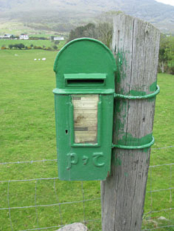 post box2.0 mi
Explorer Tom Post box in Boher has got a P&T emblem on the cast-iron box from around 1930. It’s a reminder of when Ireland changed…
 Bere IslandIsland · 5.4 mi
Explorer Tom Bere Island has the look of a harbour guard who never clocks off. Bere Island lies across Bantry Bay like a long stone…
 Greenane RockIslet · 5.9 mi
Explorer Tom Greenane Rock in County Cork definitely does something shady when nobody’s looking, like rearranging its own stones.…
More archaeology and monuments in County Cork · All of County Cork

What do you know about this place?Tap to add a comment or ask a question